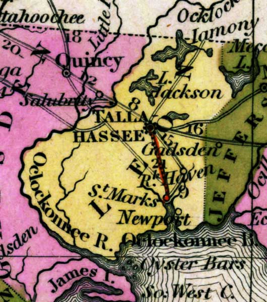
Description: This detail of a map from the Tanner's Universal Atlas shows towns, forts, roads, canals, major rivers and lakes in Leon County. The main waterways in the detail are the Ocklockonnee River, Lake Jackson, and Iamony Lake. Tallahassee is shown in bold font. Off the coast, oyster bars are indicated. There are references to forts, battlefields, and routes used by the Army during the Seminole War. The Longitude is from the Washington Prime Meridian.
Place Names: Leon, Lake Jackson, Iamony Lake, Tallahassee, River Haven, Saint Marks, Newport, Ocklockonnee Bay, Ocklockonnee River,
ISO Topic Categories: boundaries, inlandWaters, oceans, society, transportation
Keywords: Detail - Florida, physical, political, transportation, historical, physical features, county borders, roads, other military, boundaries, inlandWaters, oceans, society, transportation, Unknown,1839
Source: Henry Schenck Tanner, Tanner's Universal Atlas (Philadelphia, PA: Carey & Hart, 1839) 21
Map Credit: Courtesy the private collection of Roy Winkelman |
|