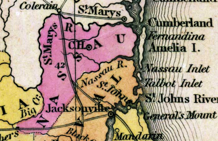
Description: This detail of a map from the Tanner's Universal Atlas shows towns, forts, roads, canals, major rivers and lakes in Nassau County. The northern border of Nassau Coutny is the Saint Mary's River, while on the south is the Nassau River. Coastal features include Cumberland Sound, Fernandina, and Amelia Island. There are references to forts, battlefields, and routes used by the Army during the Seminole War. The Longitude is from the Washington Prime Meridian.
Place Names: Nassau, Saint Mary's River, Cumberland Sound, Fernandina, Amelia Island, Big Creek, Nassau
ISO Topic Categories: boundaries, inlandWaters, oceans, society, transportation
Keywords: Detail - Florida, physical, political, transportation, historical, physical features, county borders, roads, other military, boundaries, inlandWaters, oceans, society, transportation, Unknown,1839
Source: Henry Schenck Tanner, Tanner's Universal Atlas (Philadelphia, PA: Carey & Hart, 1839) 21
Map Credit: Courtesy the private collection of Roy Winkelman |
|