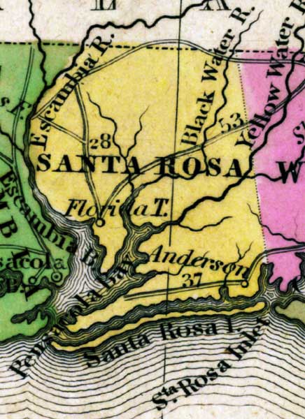
Description: This detail of a map from the Tanner's Universal Atlas shows towns, forts, roads, canals, major rivers and lakes in Santa Rosa County. The main waterways through this detail are Escambia, Black Water, and Yellow Water Rivers. The coast features Pensacola Bay, Santa Rosa Island, and Escambia Bay. There are references to forts, battlefields, and routes used by the Army during the Seminole War. The Longitude is from the Washington Prime Meridian.
Place Names: Santa Rosa, Escambia River, Black Water River, Yellow Water River, Escambia Bay, Pensacola Bay, Santa Rosa Island, Santa Rosa Inlet, Blackwater
ISO Topic Categories: boundaries, inlandWaters, oceans, society, transportation
Keywords: Detail - Florida, physical, political, transportation, historical, physical features, county borders, roads, other military, boundaries, inlandWaters, oceans, society, transportation, Unknown,1839
Source: Henry Schenck Tanner, Tanner's Universal Atlas (Philadelphia, PA: Carey & Hart, 1839) 21
Map Credit: Courtesy the private collection of Roy Winkelman |
|