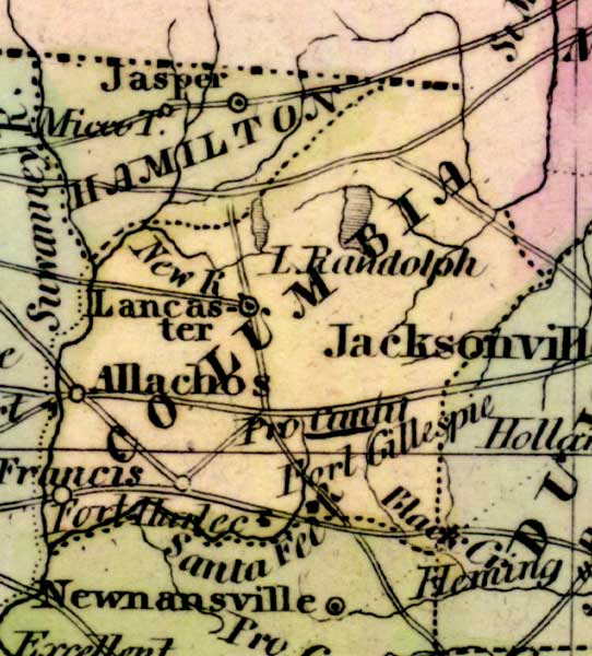
Description: This detail of a 1842 map of Florida shows roads, railroads, counties, forts, naval depots and other military installations, major towns, rivers, and lakes for Columbia County. The main waterways for this detail are Lake Randolph, New River, and Saint Mary's River. The larger towns in the county are Allachos and Lancaster. Longitude is shown from Greenwich at the top of the map, and Washington at the bottom of the map. The map scale is in &quoe;American Miles."
Place Names: Columbia, New River, Lake Randolph, Lancaster, Allachos, St Francis, Fort Hardee, Fort Gillespie, Santa Fe River, Saint Mary's River,
ISO Topic Categories: boundaries, inlandWaters, oceans, society
Keywords: Detail - Map of the State of Florida, physical, political, transportation, historical, physical features, major political subdivisions, county borders, roads, boundaries, inlandWaters, oceans, society, Unknown,1842
Source: Jeremiah Greenleaf, A New Universal Atlas (Brattleboro, VT: , 1842) 56
Map Credit: Courtesy the private collection of Roy Winkelman |
|