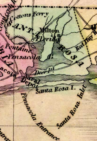
Description: This detail of a 1842 map of Florida shows roads, railroads, counties, forts, naval depots and other military installations, major towns, rivers, and lakes for Santa Rosa County. This detail has a largest town of Milton. On the coast, it features Santa Rosa Island and Pensacola Bay. Longitude is shown from Greenwich at the top of the map, and Washington at the bottom of the map. The map scale is in &quoe;American Miles."
Place Names: Santa Rosa, Cottons Ferry, Milton, Deer Point, Santa Rosa Island, Santa Rosa Inlet, Pensacola Bay,
ISO Topic Categories: boundaries, inlandWaters, oceans, society
Keywords: Detail - Map of the State of Florida, physical, political, transportation, historical, physical features, major political subdivisions, county borders, roads, boundaries, inlandWaters, oceans, society, Unknown,1842
Source: Jeremiah Greenleaf, A New Universal Atlas (Brattleboro, VT: , 1842) 56
Map Credit: Courtesy the private collection of Roy Winkelman |
|