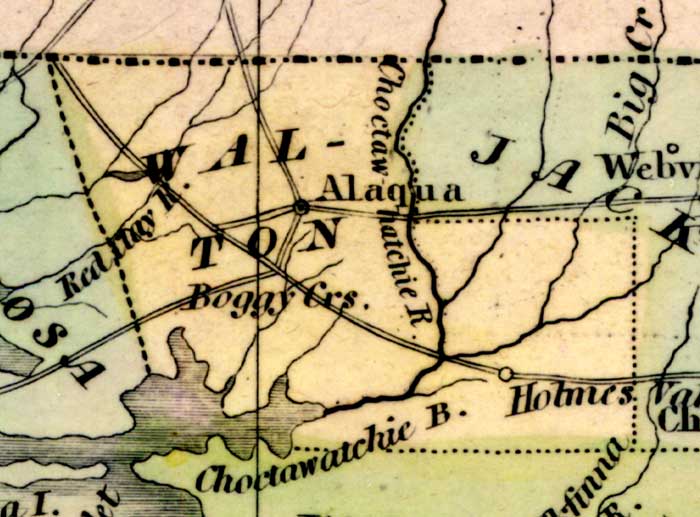
Description: This detail of a 1842 map of Florida shows roads, railroads, counties, forts, naval depots and other military installations, major towns, rivers, and lakes for Walton County. The Chocktawhatchee River runs through the middle of Walton County. Other waterways include Boggy Creeks and Red Bay River. Longitude is shown from Greenwich at the top of the map, and Washington at the bottom of the map. The map scale is in &quoe;American Miles."
Place Names: Walton, Alaqua Creek, Boggy, Holmes Valley, Red Bay, Choctawhatcheee River,
ISO Topic Categories: boundaries, inlandWaters, oceans, society
Keywords: Detail - Map of the State of Florida, physical, political, transportation, historical, physical features, major political subdivisions, county borders, roads, boundaries, inlandWaters, oceans, society, Unknown,1842
Source: Jeremiah Greenleaf, A New Universal Atlas (Brattleboro, VT: , 1842) 56
Map Credit: Courtesy the private collection of Roy Winkelman |
|