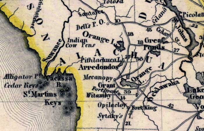
Description: Meyer's 1845 map of Florida is derived from the Tanner/Mitchell Universal atlas map of 1839. This detail of that map covers Alachua County. Routes of travel are covered along with major waterways. Some of these for this detail are Suwannee River and Orange Lake. Various keys are shown along the coast.
Place Names: Alachua, Arrendondo, Orange Lake, Fort Drane, Suwannee River, Mecanopy, Saint Martin's Key, Cedar Keys,
ISO Topic Categories: boundaries, inlandWaters, oceans, society, transportation
Keywords: Alachua County, physical, political, transportation, historical, physical features, major political subdivisions, roads, boundaries, inlandWaters, oceans, society, transportation, Unknown,1845
Source: Joseph Meyer, Grosser Hand-Atlas uber alle Theile der Erde (Hillsburghaus, : Hildburghausen: Bibliographischen Instituts, 1845) 148
Map Credit: Courtesy the private collection of Roy Winkelman |
|