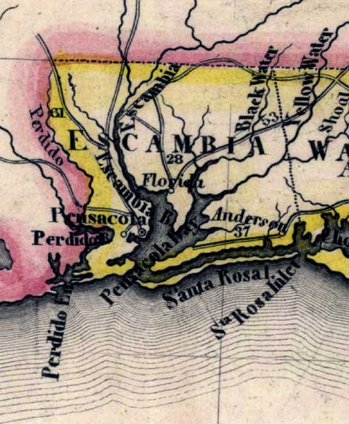
Description: Meyer's 1845 map of Florida is derived from the Tanner/Mitchell Universal atlas map of 1839. This detail of that map covers Escambia County. Routes of travel are covered along with major waterways. Some of these for this detail are the Escambia River and Yellow Water. Inlets along the coast are also pictured.
Place Names: Escambia, Pensacola, Escambia River, Perdido, Santa Rosa, Yellow Water, Black Water, Shoal, Anderson,
ISO Topic Categories: boundaries, inlandWaters, oceans, society, transportation
Keywords: Escambia County, physical, political, transportation, historical, physical features, major political subdivisions, roads, boundaries, inlandWaters, oceans, society, transportation, Unknown,1845
Source: Joseph Meyer, Grosser Hand-Atlas uber alle Theile der Erde (Hillsburghaus, : Hildburghausen: Bibliographischen Instituts, 1845) 148
Map Credit: Courtesy the private collection of Roy Winkelman |
|