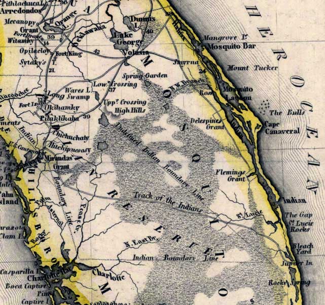
Description: Meyer's 1845 map of Florida is derived from the Tanner/Mitchell Universal atlas map of 1839. This detail of that map covers Mosquito County, which had its name changed to Orange the same year that this map came out. Routes of travel are covered along with major waterways. Much of the county is Indian Reserve, with boundaries and tracks marked across the territory.
Place Names: Mosquito, Halifax, Mangrove Island, Mosquito Bar, Mount Tucker, Mosquito Lagoon, The Bulls, Cape Canaveral, Indian River, The Gap, Saint Lucie Rocks, Saint Lucie River, Track of the Indians, Undefined Indian Boundary Line, High Hills, Upper Crossing, Spring Garden, Smyrna, Lake George, Wares Swamp, Peace River
ISO Topic Categories: boundaries, inlandWaters, oceans, society, transportation
Keywords: Mosquito County, physical, political, transportation, historical, physical features, major political subdivisions, roads, boundaries, inlandWaters, oceans, society, transportation, Unknown,1845
Source: Joseph Meyer, Grosser Hand-Atlas uber alle Theile der Erde (Hillsburghaus, : Hildburghausen: Bibliographischen Instituts, 1845) 148
Map Credit: Courtesy the private collection of Roy Winkelman |
|