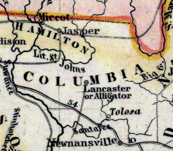
Description: Meyer's 1850 map of Florida is derived from the Tanner/Mitchell Universal atlas map of 1839, and similar to the 1845 maps. In this updated detail of Columbia County, waterways and townships are noted. The Little Saint Johns is the major water feature. Large towns include Jasper, Lancaster, and Tolosa.
Place Names: Columbia, Alligator, Lancaster, Tolosa, Little Saint Johns, Big Creek, Santa Fe River,
ISO Topic Categories: boundaries, inlandWaters, oceans, society, transportation
Keywords: Columbia County, physical, political, transportation, historical, physical features, major political subdivisions, roads, boundaries, inlandWaters, oceans, society, transportation, Unknown,1850
Source: Joseph Meyer, Grosser Hand-Atlas uber alle Theile der Erde (Hillsburghaus, : Hildburghausen: Bibliographischen Instituts, 1850) 148
Map Credit: Courtesy the private collection of Roy Winkelman |
|