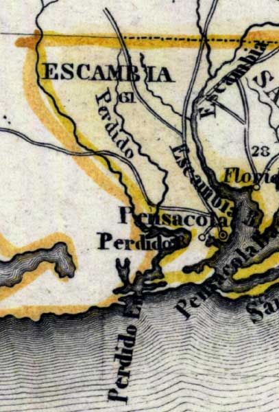
Description: Meyer's 1850 map of Florida is derived from the Tanner/Mitchell Universal atlas map of 1839, and similar to the 1845 maps. In this updated detail of Escambia County, waterways and townships are noted. The Escambia River is shown. Pensacola is shown on the coast as the largest city in the area. Coastal features include Pensacola Bay and Escambia Bay.
Place Names: Escambia, Perdido, Pensacola, Escambia River, Escambia Bay, Pensacola Bay, Perdido Bay, Perdido Key
ISO Topic Categories: boundaries, inlandWaters, oceans, society, transportation
Keywords: Escambia County, physical, political, transportation, historical, physical features, major political subdivisions, roads, boundaries, inlandWaters, oceans, society, transportation, Unknown,1850
Source: Joseph Meyer, Grosser Hand-Atlas uber alle Theile der Erde (Hillsburghaus, : Hildburghausen: Bibliographischen Instituts, 1850) 148
Map Credit: Courtesy the private collection of Roy Winkelman |
|