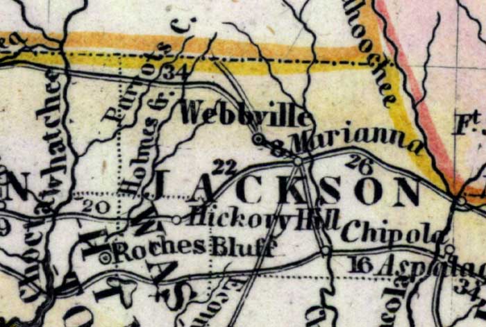
Description: Meyer's 1850 map of Florida is derived from the Tanner/Mitchell Universal atlas map of 1839, and similar to the 1845 maps. In this updated detail of Jackson County, waterways and townships are noted. The named water features are Chipola River, Holmes Creek, and Parrots Creek. The towns in the area are Webbville and Marianna.
Place Names: Jackson, Marianna, Parrots Creeek, Webbville, Roches Bluff, Hickory Hill, Chipola, Holmes Creek, Chattahoochee River, Chipola River
ISO Topic Categories: boundaries, inlandWaters, oceans, society, transportation
Keywords: Jackson County, physical, political, transportation, historical, physical features, major political subdivisions, roads, boundaries, inlandWaters, oceans, society, transportation, Unknown,1850
Source: Joseph Meyer, Grosser Hand-Atlas uber alle Theile der Erde (Hillsburghaus, : Hildburghausen: Bibliographischen Instituts, 1850) 148
Map Credit: Courtesy the private collection of Roy Winkelman |
|