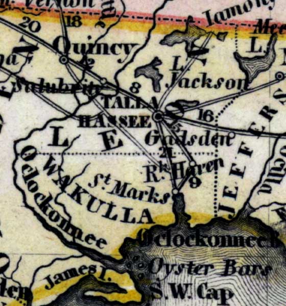
Description: Meyer's 1850 map of Florida is derived from the Tanner/Mitchell Universal atlas map of 1839, and similar to the 1845 maps. In this updated detail of Leon County, waterways and townships are noted. The named water feature is the Ocklockonee River. Iamony Lake is on the top of the detail. Tallahassee is indicated in the center.
Place Names: Leon, Lake Jackson, Tallahassee, Gadsden, Haven, Saint Marks, Quincy, Iamony, Wakulla, Ocklockonee, James Island,
ISO Topic Categories: boundaries, inlandWaters, oceans, society, transportation
Keywords: Leon County, physical, political, transportation, historical, physical features, major political subdivisions, roads, boundaries, inlandWaters, oceans, society, transportation, Unknown,1850
Source: Joseph Meyer, Grosser Hand-Atlas uber alle Theile der Erde (Hillsburghaus, : Hildburghausen: Bibliographischen Instituts, 1850) 148
Map Credit: Courtesy the private collection of Roy Winkelman |
|