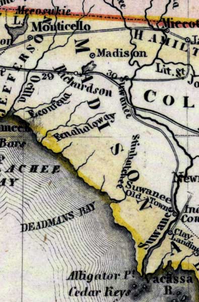
Description: Meyer's 1850 map of Florida is derived from the Tanner/Mitchell Universal atlas map of 1839, and similar to the 1845 maps. In this updated detail of Madison County, waterways and townships are noted. The named water feature is the Suwannee River. Many coastal features are noted such as the Econfena and Fenaholoway rivers and Deadmans Bay. Madison and Richardson are the largest towns noted.
Place Names: Madison, Madison, Suwannee River, Econfena, Fenahaloway, Stinhatchee, Clay Landing, Richardson, Deadmans Bay, Alligator Point, Cedar Keys,
ISO Topic Categories: boundaries, inlandWaters, oceans, society, transportation
Keywords: Madison County, physical, political, transportation, historical, physical features, major political subdivisions, roads, boundaries, inlandWaters, oceans, society, transportation, Unknown,1850
Source: Joseph Meyer, Grosser Hand-Atlas uber alle Theile der Erde (Hillsburghaus, : Hildburghausen: Bibliographischen Instituts, 1850) 148
Map Credit: Courtesy the private collection of Roy Winkelman |
|