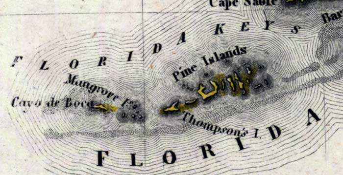
Description: Meyer's 1850 map of Florida is derived from the Tanner/Mitchell Universal atlas map of 1839, and similar to the 1845 maps. In this updated detail of the lower keys of Monroe County, waterways and townships are noted. The tip of Cape Sable is visible. The labeled keys are Pine Islands, Thompson's Island, Mangrove Island, and Cayo de Boca.
Place Names: Monroe, Mangrove Island, Cayo de Boca, Pine Islands, Thompson's Island, Barnes Sound, Cape Sable,
ISO Topic Categories: boundaries, inlandWaters, oceans, society, transportation
Keywords: Monroe County- Lower Keys, physical, political, transportation, historical, physical features, major political subdivisions, roads, boundaries, inlandWaters, oceans, society, transportation, Unknown,1850
Source: Joseph Meyer, Grosser Hand-Atlas uber alle Theile der Erde (Hillsburghaus, : Hildburghausen: Bibliographischen Instituts, 1850) 148
Map Credit: Courtesy the private collection of Roy Winkelman |
|