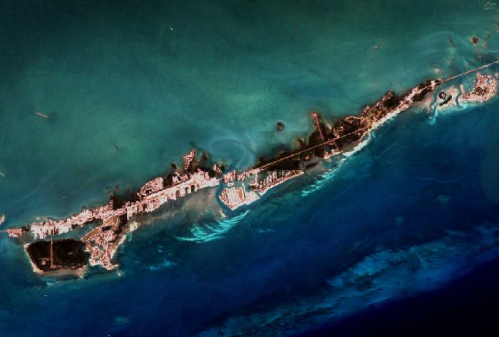
Description: This is a satellite image of coral communities on US Highway 1 in the Florida Keys taken by NASA's Landsat 7 satellite on October 25, 2000.
Place Names: Monroe, Florida Keys
ISO Topic Categories: location, biota, inlandWaters, oceans, transportation, environment
Keywords: Coral Community on US Highway 1, physical, coral, ksatellite, transportation, physical features, roads, location, biota, inlandWaters, oceans, transportation, environment, Unknown,October 25, 2000
Source: NASA Goddard Space Flight Center, (, : NASA Goddard Space Flight Center, 2000)
Map Credit: Courtesy of Scientific Visualization Studio, NASA Goddard Space Flight Center; data: NASA's Landsat Project. |
|