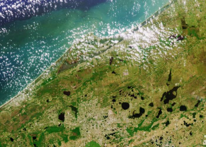
Description: Multi-angle Imaging SpectroRadiometer (MISR) images of Florida acquired on April 9, 2000 during Terra orbit 1650. This is a detail of east central Florida. The image at the top is a color view acquired by the vertical (nadir) camera. It has been reoriented so that the flight path is from left to right, to facilitate comparison with the lower image, a stereo anaglyph generated using 275-m resolution red band data from the cameras viewing 45.6 degrees and 70.5 degrees aft of nadir. The anaglyph provides a three-dimensional effect when viewed using red/blue glasses with the red filter placed over the left eye. This stereoscopic "depth perception" and the variation in brightness as a function of view angle enables scientists to assess the climate impact of different types of cloud fields. The plume from a large brush fire that burned about 15,000 acres is visible at the western edge of the Big Cypress Swamp in southern Florida.
Place Names: 2000-, Fires, Lake Okeechobee, East Central Florida, Big Cypress Swamp
ISO Topic Categories: location, inlandWaters, oceans
Keywords: 3 Dimensional Image of Florida- Detail of East Central Florida, physical, fires, kfires, ksatellite, physical features, location, inlandWaters, oceans, Unknown,April 9, 2000
Source: NASA Goddard Space Flight Center, (, : NASA Goddard Space Flight Center, 2000)
Map Credit: Courtesy of NASA/GSFC/JPL, MISR Science Team. |
|