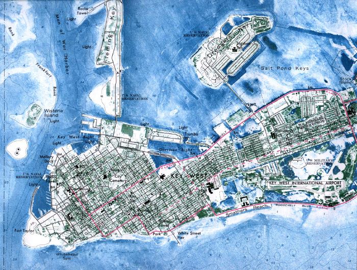
Description: This is an orthophoto map of Key West taken in 1971 by the United States Geological Survey. It shows an airport, US military reservation, US naval reservation, cemeteries, and more.
Place Names: Monroe, Key West, Smathers Beach, Salt Pond Keys, Wisteria Island
ISO Topic Categories: oceans, boundaries, location, inlandWaters, transportation
Keywords: Key West, physical, korthophotomap, transportation, political, physical features, geological, roads, oceans, boundaries, location, inlandWaters, transportation, Unknown,1971
Source: USGS, (Reston , VA: USGS, 1971)
Map Credit: Courtesy of the United States Geological Survey. |
|