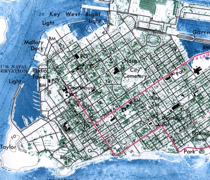
Description: This is a detailed view of an orthophoto map of Key West taken in 1971 by the United States Geological Survey. It shows a cemetery, hospital, courthouse, park, fire station, school and more.
Place Names: Monroe, Key West, Smathers Beach, Salt Pond Keys, Wisteria Island
ISO Topic Categories: oceans, boundaries, location, inlandWaters, transportation
Keywords: Key West- detail, physical, korthophotomap, transportation, political, physical features, geological, roads, oceans, boundaries, location, inlandWaters, transportation, Unknown,1971
Source: USGS, (Reston , VA: USGS, 1971)
Map Credit: Courtesy of the United States Geological Survey. |
|