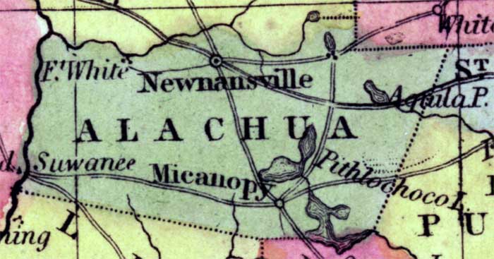
Description: This detail of a 1850 map from the New Universal Atlas shows towns, forts, roads, canals, major rivers and lakes in Alachua County. The map is very similar to the 1839 map from Tanner's Universal Atlas. There are references to forts, battlefields, and routes used by the Army during the Seminole War. Newnansville is the main town in the area.
Place Names: Alachua, Aquila Pond, Newnansville, Fort White, Suwannee, Suwanee, Micanopy, Pithlocholo Lake,
ISO Topic Categories: boundaries, inlandWaters, oceans, society, transportation
Keywords: Alachua County, physical, political, transportation, historical, physical features, county borders, roads, other military, boundaries, inlandWaters, oceans, society, transportation, Unknown,1850
Source: Samuel Augustus Mitchell, A New Universal Atlas (Philadelphia, PA: Thomas, Cowperthwait & Co., 1850) 21
Map Credit: Courtesy the private collection of Roy Winkelman |
|