| Home > Photos > Environment > Everglades | |
Click on a thumbnail photo to view the full picture.
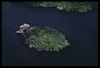
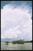
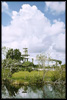
A photo of a private vacation home near the Everglades.
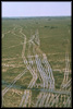
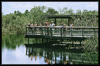
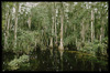
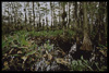
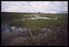
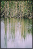
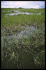
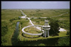
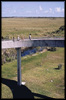
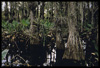
A photo of swamp buggy tracks in Big Cypress Swamp, just outside Everglades National Park. A photo of the Anhinga Trail. A photo taken in July, 1972 of the Florida Everglades along Loop Road. A photo taken in July, 1972 of Jewell Island off the coast of the Gulf of Mexico. A photo taken in July, 1972 of the Florida Everglades along Loop Road. A photo taken in July, 1972 of the Tamiami Canal in the Florida Everglades. A photo taken in July, 1972 of the Tamiami Canal in the Florida Everglades. A photo taken in July, 1972 of the Tamiami canal area. A photo taken in August, 1972 of the Shark Valley Ranger Station in the Everglades National Park. A photo taken in July, 1972 of the Shark Valley Ranger Station in the Everglades National Park. A photo taken in July, 1972 of the Loop Road area of the Florida Everglades. A photo taken in July, 1972 of the Shark Valley Ranger Station and Tower in the Florida Everglades.
| Home > Photos > Environment > Everglades |
Exploring
Florida: A Social Studies Resource for Students and Teachers
Produced by the Florida Center for Instructional
Technology,
College of Education, University of South Florida © 2002.