Module 2: Coastal Dynamics
Before continuing, please take the pre-test.
The Exploring Florida Science modules are designed to help teachers improve their content knowledge and more effectively communicate science concepts to their students. The modules focus on technology-rich science content and teaching materials that allow educators to simultaneously address multiple strands in the Sunshine State Standards for Science. Suggested lesson plans offer ideas for how teachers can incorporate these concepts in their classrooms.
Coastal dynamics is the study of changes in the beaches, marshes and other coastal zones caused by waves under normal conditions and as a result of storms. Florida’s coasts support humans and a wide range of plants, animals and microorganisms that are important to the health of aquatic and terrestrial ecosystems.
This 9 minute video clip provides an introduction to the subject of coastal dynamics and the content of this module. The featured scientists are shown at a field site at the beach, collecting data, and explaining their research on coastal systems. Corene Matyas, assistant professor in the Geography Department at the University of Florida, studies storm events like hurricanes and tornadoes, how to better predict when they will happen, and how to minimize the damages they cause. Arnoldo Valle-Levinson, associate professor in the Department of Civil and Coastal Engineering at the University of Florida, studies estuaries - the places where rivers meet the sea. He works to quantify the exchange and mixing that occurs between fresh and salt waters. Peter Adams, assistant professor in the Geology Department at the University of Florida, studies the shape of beaches and landscapes that result from geologic and coastal processes. (The video may take a moment to load.)
A text transcript of the video is available here.
Contents
Scientist’s StoriesBack to top
The Scientist’s Story feature of this module shows how the featured scientists became interested in careers in science. The featured scientists for this module are Corene Matyas (Geography), Arnoldo Valle-Levinson (Coastal Engineering), and Pete Adams (Geology). If desired, this feature can be projected in the classroom.
Content, Lessons, Activities, and ExperimentsBack to top
These resources include authentic hands-on and inquiry activities for secondary students related to this module. Teachers are invited to adapt these ideas to meet the needs of their students and their educational context.
Tropical Cyclones

Available as: [Tropical cyclone html] [Tropical cyclone pdf]
This document describes tropical cyclones and the dangers they pose to coastal populations. It is intended to help teachers improve their content knowledge of these areas. First, tropical cyclones are defined. Section two describes where these storms form, the criteria under which they form, and the forces which act to organize their circulation. Next, structural changes resulting from landfall are discussed. This is followed by a brief description of the four hazards that tropical cyclones pose to coastal populations. The maps provided illustrate how frequently these storms affect Florida and underscore why it is important to continually improve our knowledge about how these systems operate and to understand how these systems might be altered as the Earth’s climate changes.
Hands-on experiments related to tropical cyclones

Available as: [Cyclones experiments html] [Cyclones experiments pdf]
These three hands-on activities explore the questions "Is hurricane rainfall salty?", "What happens to air’s moisture content when wind blows over water?", and "How does a spinning platform impact the movement of an object?". Setup is straightforward, and these activities are suitable for any grade level.
Mapping the tracks of hurricanes

Available as: [Tracking hurricanes html] [Tracking hurricanes pdf]
These charting exercises investigate the paths that tropical cyclones have followed in the past. No special equipment is required, and these activities can be adapted for any grade level.
Beach Profiles

Available as: [Beach profiles html] [Beach profiles pdf]
This document contains information about the fundamentals of beach profiles and is intended to help teachers improve their content knowledge of ocean wave forces and coastal geomorphic response. Background addresses some of the basic information about waves and the beach profile. Methods of Measuring Beach Profiles presents the history of how coastal scientists have developed techniques of measuring beach topography (and bathymetry). Seasonal Changes in Beach Profiles discusses the natural variability in beach shape throughout the year. Human Activities and "Natural" Coastal Protection discusses the human measures that influence the physical behavior of the coast, such as river damming and emplacement of jetties, that alter the pattern of longshore sediment movement.
Surveying beach profiles

Available as: [Beach profiles html] [Beach profiles pdf]
Using only a rope and two boards, students can measure the profile (shape) of a beach and examine the relationship between the beach profile and sand grain size. This is an excellent activity for a class field trip.
Changing Coastlines

Available as: [Changing coastlines html] [Changing coastlines pdf]
This document presents information about the scales, both geographic and temporal, over which change can occur in the coastal zone. Longshore transport and storm events can dramatically alter the shape of the coastline. The student activity found at the end of this document uses maps and animations to quantify how much change is occurring at a particular site and how fast it is happening.
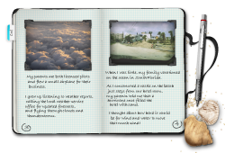
Virtual field trip to northeast coastal Florida

Available as: [Field trip PowerPoint] [Field trip pdf]
This PowerPoint presentation takes you on a virtual field trip of the barrier beaches on the northeast Florida coast. In Flagler and St. Johns Counties (south of St. Augustine), we will visit Matanzas Inlet, Marineland, and Washington Oaks Gardens State Park. We will explore and understand more about the geography and geology of the Florida coast by taking a close-up look at the sediments, examining features and processes at the landscape scale (what you see with your eyes) and interpreting from aerial photographs. On our trip, we will observe several of the multiple processes that operate concurrently at the coast, including waves, winds, tides, wave-induced currents, tidal currents, storms, and human impacts. We will learn about the importance of dune vegetation and protection, beach-dune interactions and exchanges, how sediment size deposited reflects level of energy, and observe some different sediments on Florida’s coastal beaches.
Waves, Tides, and Tsunamis

Available as: [Waves html] [Waves pdf]
In this document we will discuss three types of waves: wind-driven waves, tides and tsunamis. When the wind blows on the surface of the ocean it produces ripples, waves, and swell. Gravitational forces (mostly from the moon and sun) plus centrifugal forces in the solar system produce tides. Tectonic forces such as earthquakes that cause vertical displacements of the ocean floor, submarine volcanic eruptions, landslides and meteorite impacts on the ocean all cause tsunamis.
Waves and Tides Activities

Available as: [Waves experiments html] [Waves experiments pdf]
In these classroom activities, students can (i) use a wave tank to examine the properties of waves and (ii) calculate the propagation behavior of tsunamis and tides.
External Resources and Web Sites

A variety of coastal dynamics-related web sites and other external resources have been identified. To access these resources, click here. To see external hands-on activities and experiments, click here. These web sites and resources are stored using del.icio.us, a social bookmarking website.
Digital ResourcesBack to top
Teachers and students have access to an extensive library of digital resources for this module and a wide range of science and social studies topics. These resources include maps, photos, clip art, video and virtual reality panoramas. The list below gives a sampling of the types of resources available.
- Hurricane Route Maps of Florida
- These maps shows the routes of major hurricanes that made landfall in the United States classified on the Saffir-Simpson Hurricane Scale as category 3 or higher.
- Photo Gallery: Beaches
- Shots of different beaches throughout the state.
- Everglades
- Photographs of various parts of the Florida Everglades, including islands, ranger stations, and trails.
- Photo Gallery: Islands
- Photographs of a number of the islands located in Florida, including Little Duck Key, Long Key, Marco Island, and others.
- Photo Gallery: Lover's Key
- Photographs from this park, which consists of Lovers Key, Inner Key, Long Key, and Black Island.
- Photo Gallery: Santa Rosa Island
- Views of the nature trail and beach.
- Virtual Reality: Desoto Memorial
- This is a view from the shores of the Desoto Memorial in Bradenton, Florida.
- Virtual Reality: Everglades
- Covering 1.4 million acres, the Everglades National Park still makes up only one-fifth of the entire Everglades area.
- Virtual Reality: Everglades
- A view of a canal in the everglades. These canals wind endlessly through the everglades with the depths rarely exceeding 3 ft.
- Virtual Reality: Lovers Key
- Lovers Key State Recreation Area is made up of four islands: Lovers Key, Inner Key, Long Key, and Black Island.
- Virtual Reality: Santa Rosa Island Nature Trail
- The Dune National Trail on Santa Rosa Island winds through a beautiful area southeast of Fort Pickens.
- Virtual Reality: Weedon Island
- Weedon Island Preserve in Riviera Bay, Tampa Bay, Florida.
FCAT ConnectionsBack to top
These pdf files contain multiple-choice FCAT practice questions related to the content of this module. Question sets are targeted for grades 6-8 and grades 9-12.
Grades 6-8
Available for teachers: [FCAT questions pdf] Available for students: [FCAT questions pdf]
Grades 9-12
Available for teachers: [FCAT questions pdf] Available for students: [FCAT questions pdf]
Sunshine State StandardsBack to top
The Coastal Dynamics module focuses on topics from earth science, physics, and oceanography. The associated Sunshine State Standards are listed here for grades 6-8 and 9-12. Lists of the standards with benchmarks are provided as PDF files for each grade range. The standards listed first are the original 1996 standards.
Grades 6-8 (1996 Standards)
The 1996 Sunshine State Standards for grades 6-8 are available as a PDF to view, download, or print.
- Strand B – Energy
- 1. The student recognizes that energy may be changed in form with varying efficiency. (SC.B.1.3) BM 6
- Strand D – Processes That Shape the Earth
- 1. The student recognizes that processes in the lithosphere, atmosphere, hydrosphere and biosphere, interact to shape the Earth. (SC.D.1.3) BM 1, 3, 4
- 2. The student understands the need for protection of the natural systems on Earth. (SC.D.2.3) BM 1, 2
- Strand H – The Nature of Science
- 1. The student uses the scientific processes and habits of mind to solve problems. (SC.H.1.3) BM 1, 2, 4, 6
- 3. The student understands that science, technology and society are interwoven and interdependent. (SC.H.3.3) BM 6
Grades 9-12 (1996 standards)
The 1996 Sunshine State Standards for grades 9-12 are available as a PDF to view, download, or print.
- Strand B – Energy
- 1. The student recognizes that energy may be changed in form with varying efficiency. (SC.B.1.4) BM 1,5
- Strand D – Processes That Shape the Earth
- 1. The student recognizes that processes in the lithosphere, atmosphere, hydrosphere and biosphere, interact to shape the Earth. (SC.D.1.4) BM 3
- 2. The student understands the need for protection of the natural systems on Earth. (SC.D.2.4) BM 1
- Strand H – The Nature of Science
- 1. The student uses the scientific processes and habits of mind to solve problems. (SC.H.1.4) BM 1, 7
- 3. The student understands that science, technology and society are interwoven and interdependent. (SC.H.3.4) BM 3, 6
Grades 6-8 (2008 Standards)
- Big Idea 1: Practice of Science
- SC.6.N.1.1, SC.6.N.1.2, SC.6.N.1.3, SC.6.N.1.4, SC.6.N.1.5
- SC.7.N.1.1, SC.7.N.1.2, SC.7.N.1.3, SC.7.N.1.4, SC.7.N.1.5, SC.7.N.1.6, SC.7.N.1.7
- SC.8.N.1.1, SC.8.N.1.2, SC.8.N.1.3, SC.8.N.1.4, SC.8.N.1.5, SC.8.N.1.6
- Big Idea 3: The Role of Theories, Laws, Hypotheses, and Models
- SC.7.N.3.1, SC.7.N.3.2
- SC.8.N.3.1, SC.8.N.3.1
- Big Idea 6: Earth Structures
- SC.6.E.6.1, SC.6.E.6.2
- SC.7.E. 6.2, SC.7.E.6.4, SC.7.E.6.6
- Big Idea 7: Earth Systems and Patterns
- SC.6.E.7.2, SC.6.E.7.3, SC.6.E.7.4, SC.6.E.7.5, SC.E.6.7.6, SC.E.6.7.7, SC.E.6.7.8
- Big Idea 10: Forms of Energy
- SC.7.P.10.3
- Big Idea 11: Energy Transfer and Transformations
- SC.7.P.11.1, SC.7.P.11.2, SC.7.P.11.3, SC.7.P.11.4
Grades 9-12 (2008 Standards)
- Body of Knowledge:
- Nature of Science
- Standard 1 - The Practice of Science SC.912.N.1.1 - 1.7
- Standard 2 - The Characteristics of Scientific Knowledge SC.912.N.2.4, 2.5
- Standard 3 - The Role of Theories, Laws, Hypotheses & Models SC.912.N.3.1, 3.5
- Standard 4 - Science and Society SC.912.N.4.1, 4.2
- Earth/Space Science
- Standard 6 - Earth Structures SC.912.E.6.2, 6.4, 6.5, 6.6
- Standard 7 - Earth Systems and Patterns SC.912.E.7.1 - 7.9
- Life Sciences
- Standard 17 - Interdependence SC.912.L.17.2 - 17.10, 17.13, 17.17, 17.19, 17.20
- Physical Sciences
- Standard 10 - Energy SC.912.P.10.20
MisconceptionsBack to top
Misconceptions or alternative conceptions are beliefs that are not scientifically accurate. The teacher’s roles include identifying misconceptions and then creating experiences in which students can explore their own ideas and adopt the correct concepts. Students may have one or more of the following misconceptions about the subject of coastal dynamics. These misconceptions could be used as a starting point for classroom discussion.
- The most important reason to learn about and manage coastal resources is the protection of homes and other development.
- Storms are inherently damaging to coasts and have only negative effects on people.
- Waves and storms are well-understood and predictable.
- The work of scientists is largely done independently and in isolation. It is not a social enterprise.
- Science is most concerned with solving human problems.
Now that you've finished you can take the post-test to evaluate your progress.