| Home > Maps > 1800s, III > Florida 1889 | |
|
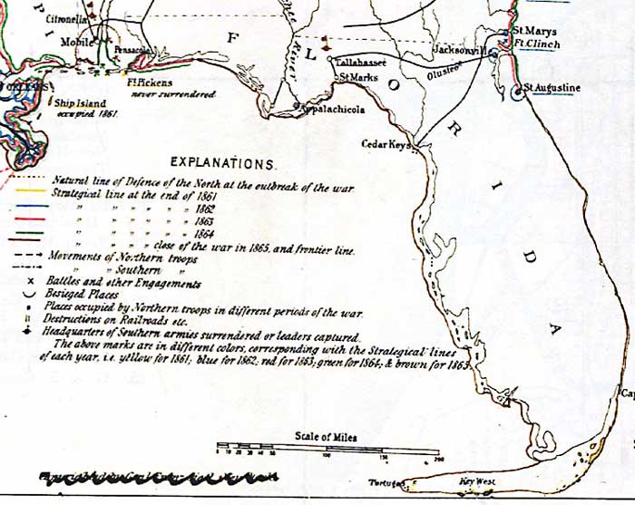
1889,
Historical sketch of the war for the Union showing the lines of demarcation, important movements and battles in each year from 1861 to the close of the war in 1865.
|
|
Map Credit: Courtesy of the Library of Congress, Geography and Map Division.
|
| Home > Maps > 1800s, III > Florida 1889 |
Exploring
Florida: A Social Studies Resource for Students and Teachers
Produced by the Florida Center for Instructional
Technology,
College of Education, University of South Florida © 2002.