| Home > Maps > 1800s, III > Florida 1888 | |

|
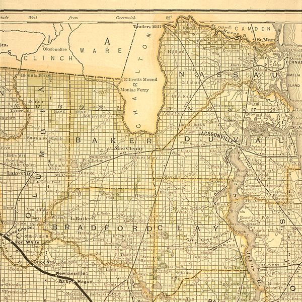
"New
sectional map of the eastern and southeastern portion of the state of
Florida. Issued by the land department of the Florida Southern Railway
Company. Showing the lands, owned and offered for sale by said department."
This map was issued in 1888. Detailed view includes Columbia, Bradford,
Nassau, Duval, Clay, and surrounding counties.
|
| Home > Maps > 1800s, III > Florida 1888 |
Exploring
Florida: A Social Studies Resource for Students and Teachers
Produced by the Florida Center for Instructional
Technology,
College of Education, University of South Florida © 2002.