Home > Maps > St. Lucie County
Site Map | Search

St. Lucie County Maps

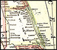
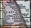
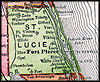
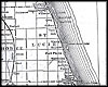
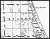
Click on a thumbnail image to view a full size version of that map.

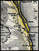
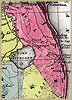
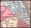
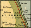
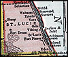
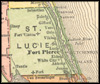
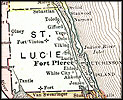
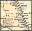
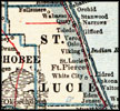
St. Lucie County is Florida's 46th county, established on May 24, 1905, from a segment of Brevard County. It gains its name from St. Lucie of Syracuse. According to legend she was executed in A.D. 304 for being a Christian and has become associated with prayers against blindness. Fort Pierce is the county seat.

For earlier maps of this area, visit the Brevard County map gallery.

link to map

1850, Aus der Gravisanstalt des Bibliographischan Instituts zu. Hillsburghaus Amsterdam Paris u. Philadelphia map.

link to map

1850, Map of Florida, published by Thomas, Cowperthwait & Co.

link to map

1857, Gaston map.

link to map 1907, Dodd, Meed and Company map.

link to map

1910, Hammond map.

link to map

1910, Rand-McNally.

link to map

1911, Rand, McNally & Company map.

link to map 1914, Collier map.

link to map

1916, National Map Company map.

link to map

1916, The New Reference Atlas of the World, published by C. S. Hammond & Company.

link to map

1917, Rand, McNally & Company map.

link to map

1920, US Railroad Administration map.

link to map

1921, L.L. Poates Co. map.

link to map

1932, United States Geological Survey.

Home > Maps > St. Lucie County
Site Map | Search

Exploring Florida: A Social Studies Resource for Students and Teachers
Produced by the Florida Center for Instructional Technology,
College of Education, University of South Florida © 2004.