|
|
|
| FL Maps > County > Pinellas |
Click on a thumbnail image to view a full size version of that map.
Pinellas County is Florida's 48th county, established on May 23, 1911, from a segment of Hillsborough County. It gains its name from a derivative of the Spanish name for the area Punta Pinal meaning "point of pines." Clearwater, originally named Clear Water Harbor because of a spring located near the Gulf coast that made the water clear and sparkling, is the county seat.
For earlier maps of this area, visit the Hillsborough County map gallery.
|
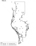
Pinellas County Cities Outline,
2009 |
|
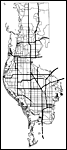
Pinellas County Road Network- Black and White,
2009 |
|
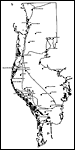
Pinellas County Railway Network- Black and White,
2009 |
|
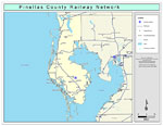
Pinellas County Railway Network- Color,
2009 |
|
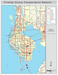
Pinellas County Road Network- Color,
2009 |
| First | Previous |
| FL Maps > County > Pinellas |
Maps ETC
is a part of the
Educational Technology Clearinghouse
Produced by the
Florida Center for Instructional Technology
© 2007
College of Education
,
University of South Florida