Maps Site map
  FL Maps > Local > Franklin
Site Map  

City and Local Maps for Franklin County

Click on a thumbnail image to view a full size version of that map.

  Record   1   to   25  of   42

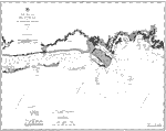
Coast Chart No. 82: Apalachee Bay and St. Georges Sound, 1883
A map of Apalachee Bay showing the Saint George Sound and Ocklockonee Bay waterways and near-shore water depths current to 1883. Soundings in deep waters are expressed in fathoms and shallow waters in feet. Variances in land surface features includin...

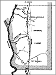
Apalachicola National Forest, 1936
This is a detailed map of the Apalachicola National Forest in Franklin County, Florida. Section Township Range (STR) is shown. This map shows state roads, railroads, tourist camps, look out tower, farm units and dwellings other than farms.

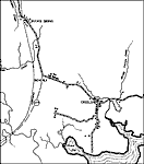
Apalachicola, 1936
This is a detailed map of the city Apalachicola in Franklin County, Florida. Section Township Range (STR) is shown. This map shows state roads, railroads, churches, forest ranger, cemeteries, businesses, airports, farm units and dwellings other than ...

Beverly, 1936
This is a detailed map of the city Beverly in Franklin County, Florida. Section Township Range (STR) is shown. This map shows roads, railroads, churches, turpentine stills, schools, businesses, saw mills, farm units and dwellings other than farms.

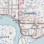
Carrabelle, 1936
This is a detailed map of the city Carrabelle in Franklin County, Florida. Section Township Range (STR) is shown. This map shows state roads, railroads, businesses, seasonal dwellings, farm units and dwellings other than farms.

Clower, 1936
This is a detailed map of the city Clower in Franklin County, Florida. Section Township Range (STR) is shown. This map shows state roads, US highways, railroads, hotel, businesses, church, school, farm units and dwellings other than farms.

East Point, 1936
This is a detailed map of the city East Point in Franklin County, Florida. Section Township Range (STR) is shown. This map shows state roads, US highways, turpentine stills, saw mills, businesses, churches, schools, tourist camp, farm units and dwell...

East Point 2, 1936
This is a detailed map of the city East Point in Franklin County, Florida. Section Township Range (STR) is shown. This map shows state roads, US highways, businesses, churches, schools, tourist camp, farm units and dwellings other than farms.

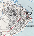
Apalachicola, 1943
This is a map of Apalachicola in Franklin County, Florida courtesy of the Pennsylvania State University map library. It shows elevation, roads, railroads, inland waters and locations of dwellings, churches and schools. Detail view from a United State...

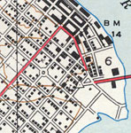
Apalachicola Riverfront, 1943
This is a map of the Apalachicola riverfront in Franklin County, Florida courtesy of the Pennsylvania State University map library. It shows elevation, roads, railroads, inland waters and locations of dwellings, churches and a school. Detail view fro...

Carrabelle, 1944
This is a map of Carrabelle in Franklin County, Florida courtesy of the Pennsylvania State University map library. It shows elevation, roads, railroads, inland waters and locations of dwellings, churches and a school. Detail view from a United States...

St. Teresa, 1945
This is a map of Saint Teresa in Franklin County, Florida courtesy of the Pennsylvania State University map library. It shows elevation, roads, marshes, inland waters, Gulf of Mexico and locations of dwellings. Detail view from a United States Geolog...

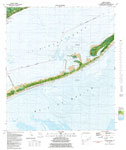
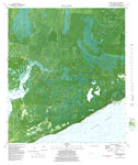
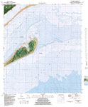
Goose Island, 1981
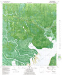
A US Geological Survey and National Ocean Service map of Goose Island, current to 1981. This orthophotomap shows both topographic and bathymetric features. Topographic and bathymetric contour intervals are shown in meters. Topographic contour lines a...

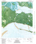
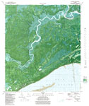
St. Teresa, 1981
A US Geological Survey and National Ocean Service map of St. Teresa, current to 1981. This orthophotomap shows both topographic and bathymetric features. opographic and bathymetric contour intervals are shown in meters. Topographic contour lines are ...

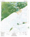
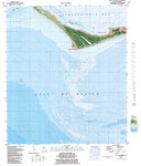
Carrabelle, 1981
A US Geological Survey and National Ocean Service map of Carrabelle, Florida current to 1981. This orthophotomap shows both topographic and bathymetric features. Topographic contour lines are shown at 2-meter intervals with supplemental contour inter...

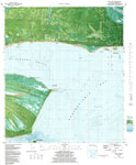
Beverly, 1981
A US Geological Survey and National Ocean Service map of the area around Beverly, Florida current to 1981. This orthophotomap shows both topographic and bathymetric features. Topographic contour lines are shown at 2-meter intervals with supplemental ...

Alligator Point, 1981
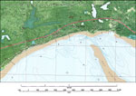
A portion of the US Geological Survey and National Ocean Service map of St. Teresa, current to 1981 showing Alligator Point. This orthophotomap shows both topographic and bathymetric features. opographic and bathymetric contour intervals are shown in...

Mouth of the Ochlockonee River, 1981
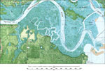
A portion of the US Geological Survey and National Ocean Service map of St. Teresa, current to 1981 showing the area at the mouth of the Ochlockonee River. This orthophotomap shows both topographic and bathymetric features. opographic and bathymetric...

Simmons Point, 1981
A portion of the US Geological Survey and National Ocean Service map of St. Teresa, current to 1981 showing the area near Simmons Point. This orthophotomap shows both topographic and bathymetric features. opographic and bathymetric contour intervals ...

Saint Teresa, 1981
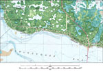
A portion of the US Geological Survey and National Ocean Service map of St. Teresa, current to 1981 showing the coastal area around St Teresa. This orthophotomap shows both topographic and bathymetric features. opographic and bathymetric contour inte...

Green Point, 1982
A US Geological Survey and National Ocean Service map of Green Point, current to 1982. This orthophotomap shows both topographic and bathymetric features. Topographic and bathymetric contour intervals are shown in meters. Topographic contour lines ar...

McIntyre, 1982
A US Geological Survey and National Ocean Service map of the Gulf Coast from McIntyre to Lanark, current to 1982. This orthophotomap shows both topographic and bathymetric features. Topographic and bathymetric contour intervals are shown in meters. T...

Cape St. George, 1982
A US Geological Survey and National Ocean Service map of Cape St, George current to 1982. The map shows both topographic and bathymetric features. Topographic contour lines are shown at 2-meter intervals with supplemental contour intervals at 1 meter...

West Pass, 1982
A US Geological Survey and National Ocean Service map of the Gulf Coast from West Pass to Green Point current to 1982. The map shows both topographic and bathymetric features. Topographic contour lines are shown at 2-meter intervals with supplemental...

Dog Island, 1982
A US Geological Survey and National Ocean Service map of Dog Island, Florida, current to 1982. This orthophotomap shows both topographic and bathymetric features. Topographic contour lines are shown at 2-meter intervals with supplemental contour inte...

Next Last


  FL Maps > Local > Franklin
Site Map  

Maps ETC is a part of the Educational Technology Clearinghouse
Produced by the Florida Center for Instructional Technology © 2007
College of Education , University of South Florida