Maps Site map
  FL Maps > Local > Hillsborough
Site Map  

City and Local Maps for Hillsborough County

Click on a thumbnail image to view a full size version of that map.

  Record   1   to   25  of   44

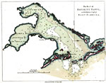
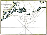
A Plan of the Entrances of Tampa Bay on the West Coast of East Florida, 1770
Digitization provided by the USF Libraries Digitization Center. Rare Maps. This is a map of the plan of entrances of Tampa Bay while it was a part of East Florida, circa 1770. It shows water depths in fathoms, islands, keys and inland waters. Measure...

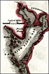
The Bay of Espiritu Santo on the Western Coast of East Florida, 1777
Digitization provided by the USF Libraries Digitization Center. Rare Maps. This is a map of the Bay of Espiritu Santo or Tampa Bay area, circa 1777. Some locations are shown such as fresh water, watering places, Black Rocks, Egmont Isle and Long Isla...

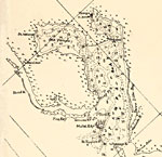
Espirito Santo Bay, 1834
Digitization provided by the USF Libraries Digitization Center. Rare Maps. This map shows the Espirito Santo Bay which is now Tampa Bay, circa 1834. It also shows inland water, U. S. Cantonment, and surrounding islands....

Detail - Preliminary chart of the northeastern part of the Gulf of Mexico, 1861
This detail of a map of the Gulf of Mexico showing the Tampa Bay area with surrounding islands and bodies of water, including bays and rivers current to 1861. The Bay's bottom contours are marked at 6, 12, and 18 feet. The map scale is 1:600,000....

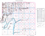
Ybor City area of Tampa, Florida, 1886
Digitization provided by the USF Libraries Digitization Center. Rare Maps. This is the plat of Ybor City area, circa 1886. It shows names of land owners, inland waters, cities and towns. Section Township Range (STR) is shown. Note on map states that ...

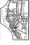
Seaboard Air Line Railroad and Connections- detail, 1917
Route map of the Seaboard Air Line Railroad in the Tampa Bay area current to 1916. The coverage area includes portions of Pasco, Pinellas, Hillsborough, Polk, and Manatee counties. This map shows connecting railroad lines and the shipping route out o...

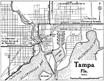
Tampa Florida, 1919
Map of Tampa, Florida in 1919 C.E. Map shows local roads and railroads. Shows Hillsborough Bay, Sparkman Bay and the Hillsborough River. The scale is given on the map. The railway lines listed are Atlantic Coast Line, Seaboard Air Line, and Tampa Nor...

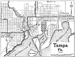
Tampa Florida, 1922
Map of Tampa, Florida in 1922 C.E. Map shows local roads and railroads. Shows Hillsborough Bay, Sparkman Bay and the Hillsborough River. ...

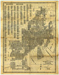
Tampa: Florida's Convenient Center, 1927
Digitization provided by the USF Libraries Digitization Center. Rare Maps. This is a detailed street map of Tampa, circa 1927. This map shows roads, railroads, cities and towns, locations and inland waters. Section Township Range (STR) is shown. This...

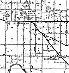
Bloomingdale, 1936
This is a detailed map of the city Bloomingdale in Hillsborough County, Florida. Section Township Range (STR) is shown. This map shows state roads, railroads, inland waters, businesses, cemeteries, a church, farm units and dwellings other than farms....

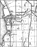
Brandon, 1936
This is a detailed map of the city Brandon in Hillsborough County, Florida. Section Township Range (STR) is shown. This map shows state roads, railroads, inland waters, businesses, cemeteries, churches, a post office, a sawmill, townhall, a school, f...

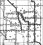
Coronet, 1936
This is a detailed map of the city Coronet in Hillsborough County, Florida. Section Township Range (STR) is shown. This map shows roads, railroads, inland waters, a business, churches, a school, a camp, farm units and dwellings other than farms.

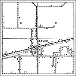
Dover, 1936
This is a detailed map of the city Dover in Hillsborough County, Florida. Section Township Range (STR) is shown. This map shows state roads, railroads, tenant houses, a post office, churches, a school, businesses, farm units and dwellings other than ...

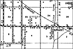
Durant, 1936
This is a detailed map of the city Durant in Hillsborough County, Florida. Section Township Range (STR) is shown. This map shows roads, railroads, inland waters, a cemetery, a church, a sawmill, businesses, farm units and dwellings other than farms. ...

Durant 2, 1936
This is a detailed map of the city Durant in Hillsborough County, Florida. Section Township Range (STR) is shown. This map shows state roads, railroads, inland waters, businesses, a cemetery, a sawmill, farm units and dwellings other than farms.

Gibsonton, 1936
This is a detailed map of the city Gibsonton in Hillsborough County, Florida. Section Township Range (STR) is shown. This map shows US highways, state roads, railroads, inland waters, businesses, camps, a cemetery, a church, farm units and dwellings ...

Hopewell, 1936
This is a detailed map of the city Hopewell in Hillsborough County, Florida. Section Township Range (STR) is shown. This map shows state roads, railroads, inland waters, businesses, schools, churches, a cemetery, a power plant, a factory, farm units ...

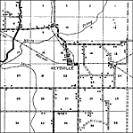
Keysville, 1936
This is a detailed map of the city Keysville in Hillsborough County, Florida. Section Township Range (STR) is shown. This map shows roads, railroads, inland waters, businesses, churches, a school, farm units and dwellings other than farms.

Knights, 1936
This is a detailed map of the city Knights in Hillsborough County, Florida. Section Township Range (STR) is shown. This map shows state roads, railroads, inland waters, churches, schools, businesses, farm units and dwellings other than farms.

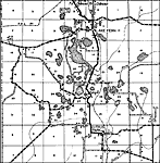
Lake Fern, 1936
This is a detailed map of the city Lake Fern in Hillsborough County, Florida. Section Township Range (STR) is shown. This map shows roads, railroads, inland waters, seasonal dwellings, a church, a school, a camp, businesses, farm units and dwellings ...

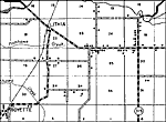
Lithia, 1936
This is a detailed map of the city Lithia in Hillsborough County, Florida. Section Township Range (STR) is shown. This map shows state roads, railroads, inland waters, schools, businesses, churches, farm units and dwellings other than farms.

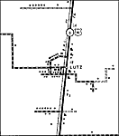
Lutz, 1936
This is a detailed map of the city Lutz in Hillsborough County, Florida. Section Township Range (STR) is shown. This map shows US highways, state roads, railroads, businesses, a school, a cemetery, a church, farm units and dwellings other than farms....

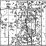
Lutz 2, 1936
This is a detailed map of the city Lutz in Hillsborough County, Florida. Section Township Range (STR) is shown. This map shows US highways, state roads, railroads, inland waters, businesses, farm units and dwellings other than farms.

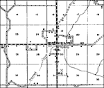
Mango, 1936
This is a detailed map of the city Mango in Hillsborough County, Florida. Section Township Range (STR) is shown. This map shows state roads, railroads, inland waters, businesses, seasonal dwellings, camps, a church, a school, farm units and dwellings...

Picnic, 1936
This is a detailed map of the city Picnic in Hillsborough County, Florida. Section Township Range (STR) is shown. This map shows roads, inland waters, churches, a school, a cemetery, a forest ranger lookout station, a business, farm units and dwellin...

Next Last


  FL Maps > Local > Hillsborough
Site Map  

Maps ETC is a part of the Educational Technology Clearinghouse
Produced by the Florida Center for Instructional Technology © 2007
College of Education , University of South Florida