Maps Site map
  FL Maps > Local > Lake
Site Map  

City and Local Maps for Lake County

Click on a thumbnail image to view a full size version of that map.

  Record   1   to   22  of   22

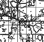
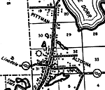
Altoona, 1936
This is a detailed map of the city Altoona in Lake County, Florida. Section Township Range (STR) is shown. This map shows state roads, inland waters, railroads, churches, a post office, businesses, schools, an airport, farm units and dwellings other ...

Astor Park, 1936
This is a detailed map of the city Astor Park in Lake County, Florida. Section Township Range (STR) is shown. This map shows state roads, inland waters, businesses, post offices, a hotel, sawmill, a school, tenant houses, farm units and dwellings oth...

South Clermont, 1936
This is a detailed map of the city South Clermont in Lake County, Florida. Section Township Range (STR) is shown. This map shows state roads, inland waters, businesses, a post office, farm units and dwellings other than farms.

Clermont 2, 1936
This is a detailed map of the city Clermont in Lake County, Florida. Section Township Range (STR) is shown. This map shows state roads, inland waters, railroads, businesses, a church, farm units and dwellings other than farms.

Eustis, 1936
This is a detailed map of the city Eustis in Lake County, Florida. Section Township Range (STR) is shown. This map shows state roads, inland waters, railroads, an airport, businesses, sawmill, tenant houses, a camp, farm units and dwellings other tha...

Grand Island, 1936
This is a detailed map of the city Grand Island in Lake County, Florida. Section Township Range (STR) is shown. This map shows state roads, inland waters, railroads, businesses, farm units and dwellings other than farms. Key...

Groveland, 1936
This is a detailed map of the city Groveland in Lake County, Florida. Section Township Range (STR) is shown. This map shows state roads, inland waters, railroads, tenant houses, a business, farm units and dwellings other than farms.

Leesburg, 1936
This is a detailed map of the city Leesburg in Lake County, Florida. Section Township Range (STR) is shown. This map shows state roads, inland waters, railroads, airports, a camp, businesses, a post office, a school, farm units and dwellings other th...

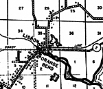
Lisbon, 1936
This is a detailed map of the city Lisbon in Lake County, Florida. Section Township Range (STR) is shown. This map shows state roads, inland waters, railroads, schools, churches, a cemetery, a business, farm units and dwellings other than farms.

Okahumpka, 1936
This is a detailed map of the city Okahumpka in Lake County, Florida. Section Township Range (STR) is shown. This map shows state roads, inland waters, railroads, businesses, tenant houses, a post office, sawmill, farm units and dwellings other than ...

Paisley, 1936
This is a detailed map of the city Paisley in Lake County, Florida. Section Township Range (STR) is shown. This map shows state roads, inland waters, a post office, a church, a school, sawmill, a business, farm units and dwellings other than farms. <...

Mount Plymouth, 1936
This is a detailed map of the city Mount Plymouth in Lake County, Florida. Section Township Range (STR) is shown. This map shows US highways, state roads, inland waters, railroads, a church, a school, an airport, businesses, a hotel, a post office, f...

Sorrento, 1936
This is a detailed map of the city Sorrento in Lake County, Florida. Section Township Range (STR) is shown. This map shows state roads, inland waters, railroads, businesses, an airport, a hotel, farm units and dwellings other than farms.

Tavares, 1936
This is a detailed map of the city Tavares in Lake County, Florida. Section Township Range (STR) is shown. This map shows US highways, state roads, inland waters, railroads, businesses, tenant houses, farm units and dwellings other than farms.

Umatilla, 1936
This is a detailed map of the city Umatilla in Lake County, Florida. Section Township Range (STR) is shown. This map shows state roads, inland waters, railroads, businesses, turpentine still, a school, a post office, an airport, farm units and dwelli...

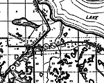
Hydrology of the Oklawaha Lakes Area of Florida- Lake Griffin, 1974
This is a map showing Lake Griffin in Lake County, current to 1974. It shows its average altitude, surface area and mean depth below altitude. "Lake Griffin has been regulated to some extent for more than 30 years by a control in the Oklawaha Ri...

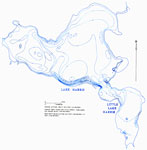
Hydrology of the Oklawaha Lakes Area of Florida- Lake Harris and Little Lake Harris, 1974
This is a map showing Lake Harris and Little Lake Harris in Lake County, current to 1974. It shows its average altitude, surface area and mean depth below altitude. "Lake Harris and Little Lake Harris combined contain the largest volume of water...

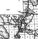
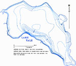
Hydrology of the Oklawaha Lakes Area of Florida- Lake Yale, 1974
This is a map showing Lake Yale in Lake County, current to 1974. It shows its average altitude, surface area and mean depth below altitude. "Lake Yale is the best (in quality) in the chain because of relative lack of nutrient sources." &mda...

Hydrology of the Oklawaha Lakes Area of Florida- Lake Dora, 1974
This is a map showing Lake Dora in Lake County, current to 1974. It shows its average altitude, surface area and mean depth below altitude. "The level of Lakes Dora, Beauclair, and Carlton seems to more closely match the level of lakes Eustis an...

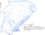
Hydrology of the Oklawaha Lakes Area of Florida- Lake Eustis, 1974
This is a map showing Lake Eustis in Lake County, current to 1974. It shows its average altitude, surface area and mean depth below altitude. "The quality of lakes Eustis and Griffin is better than that of the lakes upstream of Dora Canal becaus...

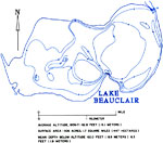
Hydrology of the Oklawaha Lakes Area of Florida- Lake Beauclair, 1974
This is a map showing Lake Beauclair in Lake County, current to 1974. It shows its average altitude, surface area and mean depth below altitude. "The level of Lakes Dora, Beauclair, and Carlton seems to more closely match the level of lakes Eust...

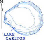
Hydrology of the Oklawaha Lakes Area of Florida- Lake Carlton, 1974
This is a map showing Lake Carlton in Lake County, current to 1974. It shows its average altitude, surface area and mean depth below altitude. "Lakes Apopka, Carlton, Beauclair, and Dora are among the 10 most eutrophic of the 104 lakes studied. ...


  FL Maps > Local > Lake
Site Map  

Maps ETC is a part of the Educational Technology Clearinghouse
Produced by the Florida Center for Instructional Technology © 2007
College of Education , University of South Florida