Maps Site map
  FL Maps > Local > Levy
Site Map  

City and Local Maps for Levy County

Click on a thumbnail image to view a full size version of that map.

  Record   1   to   16  of   16

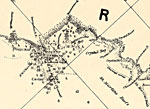
Detail - Preliminary chart of the northeastern part of the Gulf of Mexico, 1861
This detail of a map of the Gulf of Mexico showing the Cedar Key area with surrounding islands and bodies of water, including bays and rivers current to 1861. Many channels and rivers are depicted in the detail. The depths and soundings are noted wit...

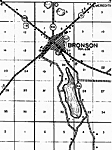
Bronson, 1936
This is a detailed map of the city Bronson in Levy County, Florida. Section Township Range (STR) is shown. This map shows state roads, US highway, county seat, businesses, tenant house, farm units and dwellings other than farms.

Chiefland, 1936
This is a detailed map of the city Chiefland in Levy County, Florida. Section Township Range (STR) is shown. This map shows state roads, railroads, tenant houses, businesses, forest ranger lookout station, churches, schools, a cemetery, farm units an...

Crackertown, 1936
This is a detailed map of the city Crackertown in Levy County, Florida. Section Township Range (STR) is shown. This map shows state roads, schools, a church, a powerplant, businesses, a camp, farm units and dwellings other than farms.

Double Sink, 1936
This is a detailed map of the city Double Sink in Levy County, Florida. Section Township Range (STR) is shown. This map shows state roads, schools, churches, tenant houses, businesses, a cemetery, farm units and dwellings other than farms.

Gulf Hammock, 1936
This is a detailed map of the city Gulf Hammock in Levy County, Florida. Section Township Range (STR) is shown. This map shows state roads, railroads, a post office, a school, businesses, a camp, a sawmill, farm units and dwellings other than farms. ...

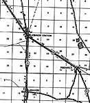
Lebanon, 1936
This is a detailed map of the city Lebanon in Levy County, Florida. Section Township Range (STR) is shown. This map shows state roads, railroads, forest ranger lookout station, a factory, businesses, sawmill, turpentine still, farm units and dwelling...

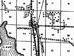
Montbrook, 1936
This is a detailed map of the city Montbrook in Levy County, Florida. Section Township Range (STR) is shown. This map shows state roads, US highways, railroads, tenant houses, a school, a post office, churches, businesses, farm units and dwellings ot...

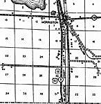
Morriston, 1936
This is a detailed map of the city Morriston in Levy County, Florida. Section Township Range (STR) is shown. This map shows state roads, US highways, railroads, churches, a school, businesses, a camp, farm units and dwellings other than farms.

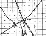
Otter Creek, 1936
This is a detailed map of the city Otter Creek in Levy County, Florida. Section Township Range (STR) is shown. This map shows state roads, railroads, schools, churches, emergency landing field, sawmill, a camp, businesses, farm units and dwellings ot...

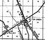
Otter Creek 2, 1936
This is a detailed map of the city Otter Creek in Levy County, Florida. Section Township Range (STR) is shown. This map shows roads, railroads, schools, churches, emergency landing field, sawmill, a camp, businesses, farm units and dwellings other th...

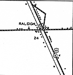
Raleigh, 1936
This is a detailed map of the city Raleigh in Levy County, Florida. Section Township Range (STR) is shown. This map shows state roads, US highways, railroads, a church, a cemetery, a business, a camp, farm units and dwellings other than farms.

Raleigh Insert, 1936
This is a detailed map of the city Raleigh in Levy County, Florida. Section Township Range (STR) is shown. This map shows state roads, US highways, railroads, businesses, a post office, churches, tenant houses, farm units and dwellings other than far...

Rosewood, 1936
This is a detailed map of the city Rosewood in Levy County, Florida. Section Township Range (STR) is shown. This map shows state roads, churches, a post office, a business, turpentine stills, farm units and dwellings other than farms.

Williston, 1936
This is a detailed map of the city Williston in Levy County, Florida. Section Township Range (STR) is shown. This map shows state roads, US highways, railroads, churches, cemeteries, businesses, tenant houses, schools, townhall, camps, farm units and...

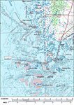
Cedar Keys, 1978
A US Geological Survey and National Ocean Service map of the Cedar Keys, current to 1978. The map shows both topographic and bathymetric features. Topographic contour lines are shown at 5-meter intervals. Bathymetric contour intervals are at 2 meters...


  FL Maps > Local > Levy
Site Map  

Maps ETC is a part of the Educational Technology Clearinghouse
Produced by the Florida Center for Instructional Technology © 2007
College of Education , University of South Florida