Maps Site map
  FL Maps > State > 1780-1799
Site Map  

  Record   1   to   4  of   4

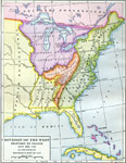
Division of the West, 1782
A map of Florida as a Spanish possession stretching from the Mississippi River eastward to the Atlantic Ocean. To the north of Florida are American Indian lands under the protection of the Spanish, a small area of American Indian lands under the pro...

Florida, 1783
Digitization provided by the USF Libraries Digitization Center. Rare Maps. This is a map of Florida including west Cuba showing inland waters and towns in Spanish, circa 1783. It is an inset map from a hand colored map of the Saint Augustine region. ...

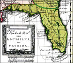
Kaart van Louisians, en Florida, 1785
A portion of Bachiene's 1785 map of the Southeastern United States and the Mississippi River Valley based on Rigobert Bonne's map. Florida is shown extending westward to include Mobile (AL) and Biloxi (MS). Digitization provided by the USF Libraries...

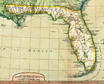
Detail of Florida from A New and General Map of the Southern Dominions Belonging to the United States of America, 1794
Digitization provided by the USF Libraries Digitization Center. Rare Maps. This is a map of Florida divided into West and East Florida, circa 1794. It is a portion of the map of the Southern Dominions belonging to the United States of America. It sho...


  FL Maps > State > 1780-1799
Site Map  

Maps ETC is a part of the Educational Technology Clearinghouse
Produced by the Florida Center for Instructional Technology © 2007
College of Education , University of South Florida