|
|
|
| FL Maps > County > Levy |
Click on a thumbnail image to view a full size version of that map.
Levy County is Florida's 26th county, established on March 10, 1845, from a segment of Alachua County. It gains its name from David Levy Yulee, who served as the first U.S. Senator for Florida. Bronson is the county seat.
For earlier maps of this area, visit the Alachua County map gallery.
|
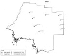
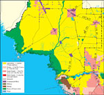
Levy County Cities with Labels,
2009 |

|
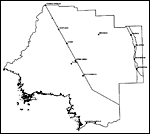
Levy County Cities Outline,
2009 |
|
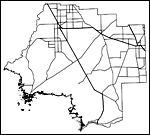
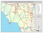
Levy County Road Network- Black and White,
2009 |
|
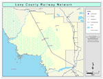
Levy County Railway Network- Black and White,
2009 |
|
Levy County Railway Network- Color,
2009 |
|
Levy County Road Network- Color,
2009 |
|
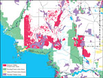
Withlacoochee River Watershed Distribution of Generalized Future Land Use, Ca. 2010- Levy County,
May 9, 2001 |
|
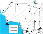
Withlacoochee River Watershed Distribution of Hazardous Waste Clean Up Sites, Landfills and Wastewater Facilities- Levy County,
May 9, 2001 |
|
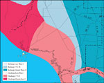
Withlacoochee River Watershed Recharge to/Discharge from the Floridan Aquifer In Inches Per Year- Levy County,
May 9, 2001 |
|
Withlacoochee River Watershed Strategic Habitat Conservation Areas, Areas of Conservation Interest, and Potential Natural Areas- Levy County,
May 9, 2001 |
| First | Previous |
| FL Maps > County > Levy |
Maps ETC
is a part of the
Educational Technology Clearinghouse
Produced by the
Florida Center for Instructional Technology
© 2007
College of Education
,
University of South Florida