Maps Site map
  FL Maps > Local > Brevard
Site Map  

City and Local Maps for Brevard County

Click on a thumbnail image to view a full size version of that map.

  Record   26   to   37  of   37

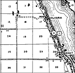
Valkaria, 1936
This is a detailed map of the city Valkaria in Brevard County, Florida. Section Township Range (STR) is shown. This map shows US highways, state roads, railroads, inland waters, a lighthouse, camps, schools, businesses, hotels, farm units and dwellin...

Wilson, 1936
This is a detailed map of the city Wilson in Brevard County, Florida. Section Township Range (STR) is shown. This map shows state roads, inland waters, a school, farm units and dwellings other than farms. Key to Florida ...

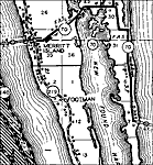
Merritt Island, 1936
This is a detailed map of the city Merritt Island in Brevard County, Florida current to 1936. Section Township Range (STR) is shown. This map shows state roads, inland waters, bridges, businesses, post offices, a saw mill, farm units and dwellings ot...

Micco, 1936
This is a detailed map of the city Micco in Brevard County, Florida. Section Township Range (STR) is shown. This map shows state roads, railroads, inland waters, businesses, schools, camps, post offices, farm units and dwellings other than farms.

Port Canaveral, 1975
A National Oceanic and Atmospheric Administration map of Port Canaveral current to 1975. This Department of Commerce chart shows all soundings expressed in feet at mean low water. Navigational aids such as lights, beacons, buoys and measures of magne...

Canaveral Barge Canal Extension, 1975
A National Oceanic and Atmospheric Administration map of Canaveral Barge Canal extension current to 1975. This Department of Commerce chart shows all soundings expressed in feet at mean low water. Navigational aids such as lights, beacons and buoys a...

Cape Canaveral, 1977
A National Oceanic and Atmospheric Administration map of Cape Canaveral current to 1977. This Department of Commerce chart shows all soundings expressed in feet at mean lower low water. Navigational aids such as lights, beacons and buoys are shown as...

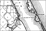
Merritt Island, 1977
A National Oceanic and Atmospheric Administration map of Merritt Island current to 1977. This Department of Commerce chart shows all soundings expressed in feet at mean lower low water. Navigational aids such as lights, beacons and buoys are shown as...

Titusville, 1977
A National Oceanic and Atmospheric Administration map of Titusville, Florida current to 1977. This Department of Commerce chart shows all soundings expressed in feet at mean lower low water. Navigational aids such as lights, beacons and buoys are sho...

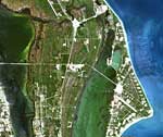
Kennedy Space Center from Landsat 7, June 3, 1999
This is a satellite image of Kennedy Space Center on June 3, 1999. NASA's Kennedy Space Center, located on Merritt Island just off the east coast of Florida, is the site of all Space Shuttle launches. This true color Landsat-7 scene shows the center,...

Cape Canaveral Area, October 4, 1994
This radar image from October 4, 1994, shows the east coast of central Florida, including the Cape Canaveral area. The Indian River, Banana River and the Atlantic Ocean are the three bodies of water (shown in deep blue) from the lower left to the upp...

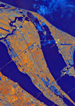
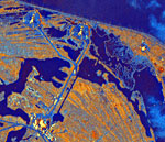
Kennedy Space Center, October 4, 1994
This is a detailed view of a radar image of the Kennedy Space Center on October 4, 1994. The light blue areas on Cape Canaveral are the launch pads used by NASA and the Air Force. The two pads in the upper left of the image (light blue hexagons with ...

First Previous


  FL Maps > Local > Brevard
Site Map  

Maps ETC is a part of the Educational Technology Clearinghouse
Produced by the Florida Center for Instructional Technology © 2007
College of Education , University of South Florida