Maps Site map
  FL Maps > Local > Franklin
Site Map  

City and Local Maps for Franklin County

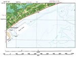
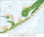
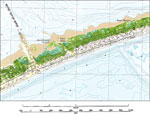
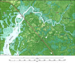
Click on a thumbnail image to view a full size version of that map.

  Record   26   to   42  of   42

Apalachicola, 1982
A US Geological Survey and National Ocean Service map of Apalachicola current to 1982. This orthophotomap shows both topographic and bathymetric features. Topographic contour lines are shown at 2-meter intervals with supplemental contour intervals at...

Eastpoint, 1982
A US Geological Survey and National Ocean Service map of the Gulf Coast from Seminole Hills to Hollywood Beach, current to 1982. This orthophotomap shows both topographic and bathymetric features. Topographic and bathymetric contour intervals are sho...

Saint George Island State Park, 1982
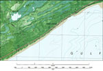
A portion of the US Geological Survey and National Ocean Service map of the Gulf Coast from Seminole Hills to Hollywood Beach, current to 1982 showing the Saint George Island State Park. This orthophotomap shows both topographic and bathymetric featu...

Saint George Island, 1982
A portion of the US Geological Survey and National Ocean Service map of the Gulf Coast from Seminole Hills to Hollywood Beach, current to 1982 showing the residential area of Saint George Island. This orthophotomap shows both topographic and bathymet...

Cash Bayou, 1982
A portion of the US Geological Survey and National Ocean Service map of Green Point, current to 1982 showing the area around Cash Bayou. This orthophotomap shows both topographic and bathymetric features. Topographic and bathymetric contour intervals...

Big Blackjack Landing, 1982
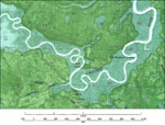
A portion of the US Geological Survey and National Ocean Service map of the Gulf Coast from McIntyre to Lanark, current to 1982 showing the Crooked River area near Big Blackjack Landing. This orthophotomap shows both topographic and bathymetric featu...

Lanark Village, 1982
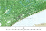
A portion of the US Geological Survey and National Ocean Service map of the Gulf Coast from McIntyre to Lanark, current to 1982 showing details of Lanark Village. This orthophotomap shows both topographic and bathymetric features. Topographic and bat...

McIntyre, 1982
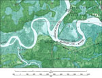
A portion of the US Geological Survey and National Ocean Service map of the Gulf Coast from McIntyre to Lanark, current to 1982 showing the area around McIntyre on the Ochlockonee River. This orthophotomap shows both topographic and bathymetric featu...

St. James, Florida, 1982
A portion of the US Geological Survey and National Ocean Service map of the Gulf Coast from McIntyre to Lanark, current to 1982 showing the coastline around St. James. This orthophotomap shows both topographic and bathymetric features. Topographic an...

Bald Point, 1982
A US Geological Survey and National Ocean Service map of Bald Point, current to 1982. The map shows both topographic and bathymetric features. Topographic contour lines are shown at 2-meter intervals with supplemental contour intervals at 1 meter. Ba...

Lighthouse Point Detail, 1982
A US Geological Survey and National Ocean Service detail map of Lighthouse Point, current to 1982. The map shows both topographic and bathymetric features. Topographic contour lines are shown at 2-meter intervals with supplemental contour intervals a...

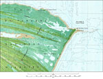
St. James Island, 1982
A US Geological Survey and National Ocean Service detail map of St. James Island, current to 1982. The map shows both topographic and bathymetric features. Topographic contour lines are shown at 2-meter intervals with supplemental contour intervals a...

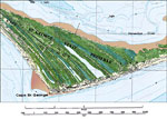
Cape St. George Detail, 1982
A US Geological Survey and National Ocean Service detail map of Cape St., George, current to 1982. The map shows both topographic and bathymetric features. Topographic contour lines are shown at 2-meter intervals with supplemental contour intervals a...

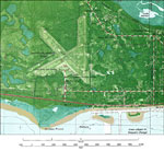
Apalachicola Airport, 1982
A US Geological Survey and National Ocean Service map of the Apalachicola Municipal Airport, current to 1982. The map shows both topographic and bathymetric features. Topographic contour lines are shown at 2-meter intervals with supplemental contour ...

St. Vincent National Wildlife Refuge, 1982
A US Geological Survey and National Ocean Service map of the St. Vincent National Wildlife Refuge, current to 1982. The map shows both topographic and bathymetric features. Topographic contour lines are shown at 2-meter intervals with supplemental co...

Tilton, 1982
A US Geological Survey and National Ocean Service map of Tilton, current to 1982. The map shows both topographic and bathymetric features. Topographic contour lines are shown at 2-meter intervals with supplemental contour intervals at 1 meter. Bathy...

Apalachicola: Florida, 1988
A National Oceanic and Atmospheric Administration topographic-bathymetric map of Apalachicola, Florida current to1988. This map shows contours and elevation in meters, highways, roads and other manmade structures, woodland areas, toponyms, and bathym...

First Previous


  FL Maps > Local > Franklin
Site Map  

Maps ETC is a part of the Educational Technology Clearinghouse
Produced by the Florida Center for Instructional Technology © 2007
College of Education , University of South Florida