Maps Site map
  FL Maps > Local > Polk
Site Map  

City and Local Maps for Polk County

Click on a thumbnail image to view a full size version of that map.

  Record   26   to   42  of   42

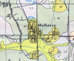
Mulberry, Florida, 1927
A section of the Soil Map for Polk County produced by the United States Department of Agriculture, Bureau of Chemistry and Soils in conjunction with the Florida State Geological Survey. This map shows roads, railroads, and the major soil groups foun...

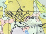
Nichols, Florida, 1927
A section of the Soil Map for Polk County produced by the United States Department of Agriculture, Bureau of Chemistry and Soils in conjunction with the Florida State Geological Survey. This map shows roads, railroads, and the major soil groups foun...

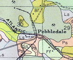
Pebbledale, Florida, 1927
A section of the Soil Map for Polk County produced by the United States Department of Agriculture, Bureau of Chemistry and Soils in conjunction with the Florida State Geological Survey. This map shows roads, railroads, and the major soil groups foun...

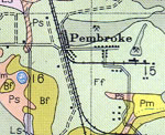
Pembroke, Florida, 1927
A section of the Soil Map for Polk County produced by the United States Department of Agriculture, Bureau of Chemistry and Soils in conjunction with the Florida State Geological Survey. This map shows roads, railroads, and the major soil groups foun...

Pierce, Florida, 1927
A section of the Soil Map for Polk County produced by the United States Department of Agriculture, Bureau of Chemistry and Soils in conjunction with the Florida State Geological Survey. This map shows roads, railroads, and the major soil groups foun...

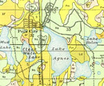
Polk City, Florida, 1927
A section of the Soil Map for Polk County produced by the United States Department of Agriculture, Bureau of Chemistry and Soils in conjunction with the Florida State Geological Survey. This map shows roads, railroads, and the major soil groups foun...

Poyner, Florida, 1927
A section of the Soil Map for Polk County produced by the United States Department of Agriculture, Bureau of Chemistry and Soils in conjunction with the Florida State Geological Survey. This map shows roads, railroads, and the major soil groups foun...

Ridgewood, Florida, 1927
A section of the Soil Map for Polk County produced by the United States Department of Agriculture, Bureau of Chemistry and Soils in conjunction with the Florida State Geological Survey. This map shows roads, railroads, and the major soil groups foun...

Rock Ridge, Florida, 1927
A section of the Soil Map for Polk County produced by the United States Department of Agriculture, Bureau of Chemistry and Soils in conjunction with the Florida State Geological Survey. This map shows roads, railroads, and the major soil groups foun...

Royster, Florida, 1927
A section of the Soil Map for Polk County produced by the United States Department of Agriculture, Bureau of Chemistry and Soils in conjunction with the Florida State Geological Survey. This map shows roads, railroads, and the major soil groups foun...

Tigerbay, Florida, 1927
A section of the Soil Map for Polk County produced by the United States Department of Agriculture, Bureau of Chemistry and Soils in conjunction with the Florida State Geological Survey. This map shows roads, railroads, and the major soil groups foun...

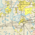
Winston, Florida, 1927
A section of the Soil Map for Polk County produced by the United States Department of Agriculture, Bureau of Chemistry and Soils in conjunction with the Florida State Geological Survey. This map shows roads, railroads, and the major soil groups foun...

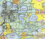
Winter Haven, Florida, 1927
A section of the Soil Map for Polk County produced by the United States Department of Agriculture, Bureau of Chemistry and Soils in conjunction with the Florida State Geological Survey. This map shows roads, railroads, and the major soil groups foun...

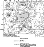
Topography of Lake Starr Basin, 2000
This map from the U. S. Geological Survey Water Resources Investigation Report number 00-4030 shows the topography and topographic basin boundary of Lake Starr in Polk County. Lake Starr, a 134-acre seepage lake of multiple sinkhole origin on the Lak...

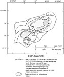
Structural Contours of Limestone Surface below Lake Starr, 2000
This map from the U. S. Geological Survey Water Resources Investigation Report number 00-4030 shows lines of equal elevation of limestone reflector surface below Lake Starr in feet above sea level as interpreted from seismic-reflection profiles. Lake...

Water Table Altitude and Groundwater Flow Direction for Lake Starr, March 1998 and May 1997
This map from the U. S. Geological Survey Water Resources Investigation Report number 00-4030 shows the water table configurations at Lake Starr during representative high water and low water conditions. Contour lines show equal water table altitude ...

Potentiometric Surface of the Upper Floridan Aquifer in the Lake Starr Basin, March 1998 and May 1997
This map from the U. S. Geological Survey Water Resources Investigation Report number 00-4030 shows the potentiometric surface of the Upper Floridan aquifer in the Lake Starr basin during representative high water and low water conditions. Contour li...

First Previous


  FL Maps > Local > Polk
Site Map  

Maps ETC is a part of the Educational Technology Clearinghouse
Produced by the Florida Center for Instructional Technology © 2007
College of Education , University of South Florida