Maps Site map
  FL Maps > Florida Sinkhole Maps
Site Map  

  Record   1   to   25  of   52

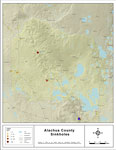
Sinkholes of Alachua County, Florida, 2008
This map was created by FCIT and represents reported sinkhole events in Alachua County based on data gathered by the Florida Geological Survey (FGS) and the Florida Department of Environmental Protection (FDEP). " This dataset represents a set o...

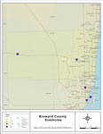
Sinkholes of Broward County, Florida, 2008
This map was created by FCIT and represents reported sinkhole events in Broward County based on data gathered by the Florida Geological Survey (FGS) and the Florida Department of Environmental Protection (FDEP). " This dataset represents a set o...

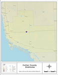
Sinkholes of Charlotte County, Florida , 1948 to 2007
This map was created by FCIT and represents reported sinkhole events in Charlotte County based on data gathered by the Florida Geological Survey (FGS) and the Florida Sinkhole Research Institute (FSRI) between 1948 and 2007. " This dataset repre...

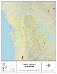
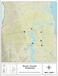
Sinkholes of Citrus County, Florida, 2008
This map was created by FCIT and represents reported sinkhole events in Citrus County based on data gathered by the Florida Geological Survey (FGS) and the Florida Department of Environmental Protection (FDEP). " This dataset represents a set of...

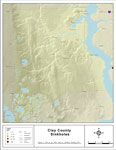
Sinkholes of Clay County, Florida, 2008
This map was created by FCIT and represents reported sinkhole events in Clay County based on data gathered by the Florida Geological Survey (FGS) and the Florida Department of Environmental Protection (FDEP). " This dataset represents a set of p...

Sinkholes of Collier County, Florida, 2008
This map was created by FCIT and represents reported sinkhole events in Collier County based on data gathered by the Florida Geological Survey (FGS) and the Florida Department of Environmental Protection (FDEP). " This dataset represents a set o...

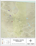
Sinkholes of Colmbia County, Florida, 2008
This map was created by FCIT and represents reported sinkhole events in Columbia County based on data gathered by the Florida Geological Survey (FGS) and the Florida Department of Environmental Protection (FDEP). " This dataset represents a set ...

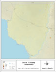
Sinkholes of Dixie County, Florida, 2008
This map was created by FCIT and represents reported sinkhole events in Dixie County based on data gathered by the Florida Geological Survey (FGS) and the Florida Department of Environmental Protection (FDEP). " This dataset represents a set of ...

Sinkholes of Duval County, Florida, 2008
This map was created by FCIT and represents reported sinkhole events in Duval County based on data gathered by the Florida Geological Survey (FGS) and the Florida Department of Environmental Protection (FDEP). " This dataset represents a set of ...

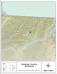
Sinkholes of Gadsden County, Florida, 2008
This map was created by FCIT and represents reported sinkhole events in Gadsden County based on data gathered by the Florida Geological Survey (FGS) and the Florida Department of Environmental Protection (FDEP). " This dataset represents a set o...

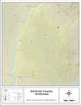
Sinkholes of Gilchrist County, Florida, 2008
This map was created by FCIT and represents reported sinkhole events in Gilchrist County based on data gathered by the Florida Geological Survey (FGS) and the Florida Department of Environmental Protection (FDEP). " This dataset represents a set...

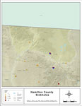
Sinkholes of Hamilton County, Florida, 2008
This map was created by FCIT and represents reported sinkhole events in Hamilton County based on data gathered by the Florida Geological Survey (FGS) and the Florida Department of Environmental Protection (FDEP). " This dataset represents a set ...

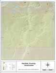
Sinkholes of Hardee County, Florida, 2008
This map was created by FCIT and represents reported sinkhole events in Hardee County based on data gathered by the Florida Geological Survey (FGS) and the Florida Department of Environmental Protection (FDEP). " This dataset represents a set of...

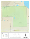
Sinkholes of Hendry County, Florida , 2008
This map was created by FCIT and represents reported sinkhole events in Hendry County based on data gathered by the Florida Geological Survey (FGS) and the Florida Department of Environmental Protection (FDEP). " This dataset represents a set of...

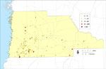
Sinkholes of Hernando County, Florida, 1948 to 2007
This map was created by FCIT and represents reported sinkhole events in Hernando County based on data gathered by the Florida Geological Survey (FGS) and the Florida Sinkhole Research Institute (FSRI) between 1948 and 2007. " This dataset repres...

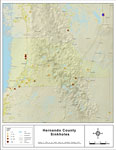
Sinkholes of Hernando County, Florida , 2008
This map was created by FCIT and represents reported sinkhole events in Hernando County based on data gathered by the Florida Geological Survey (FGS) and the Florida Department of Environmental Protection (FDEP). " This dataset represents a set ...

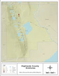
Sinkholes of Highlands County, Florida , 2008
This map was created by FCIT and represents reported sinkhole events in Highlands County based on data gathered by the Florida Geological Survey (FGS) and the Florida Department of Environmental Protection (FDEP). " This dataset represents a set...

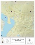
Sinkholes of Hillsborough County, Florida , 2008
This map was created by FCIT and represents reported sinkhole events in Hillsborough County based on data gathered by the Florida Geological Survey (FGS) and the Florida Department of Environmental Protection (FDEP). " This dataset represents a ...

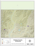
Sinkholes of Holmes County, Florida , 2008
This map was created by FCIT and represents reported sinkhole events in Holmes County based on data gathered by the Florida Geological Survey (FGS) and the Florida Department of Environmental Protection (FDEP). " This dataset represents a set of...

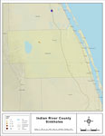
Sinkholes of Indian River County, Florida , 2008
This map was created by FCIT and represents reported sinkhole events in Indian River County based on data gathered by the Florida Geological Survey (FGS) and the Florida Department of Environmental Protection (FDEP). " This dataset represents a ...

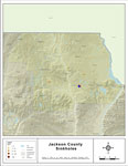
Sinkholes of Jackson County, Florida , 2008
This map was created by FCIT and represents reported sinkhole events in Jackson County based on data gathered by the Florida Geological Survey (FGS) and the Florida Department of Environmental Protection (FDEP). " This dataset represents a set o...

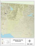
Sinkholes of Jefferson County, Florida , 2008
This map was created by FCIT and represents reported sinkhole events in Jefferson County based on data gathered by the Florida Geological Survey (FGS) and the Florida Department of Environmental Protection (FDEP). " This dataset represents a set...

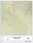
Sinkholes of Lafayette County, Florida , 2008
This map was created by FCIT and represents reported sinkhole events in Lafayette County based on data gathered by the Florida Geological Survey (FGS) and the Florida Department of Environmental Protection (FDEP). " This dataset represents a set...

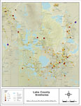
Sinkholes of Lake County, Florida , 2008
This map was created by FCIT and represents reported sinkhole events in Lake County based on data gathered by the Florida Geological Survey (FGS) and the Florida Department of Environmental Protection (FDEP). " This dataset represents a set of p...

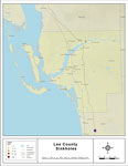
Sinkholes of Lee County, Florida , 2008
This map was created by FCIT and represents reported sinkhole events in Lee County based on data gathered by the Florida Geological Survey (FGS) and the Florida Department of Environmental Protection (FDEP). " This dataset represents a set of po...

Next Last


  FL Maps > Florida Sinkhole Maps
Site Map  

Maps ETC is a part of the Educational Technology Clearinghouse
Produced by the Florida Center for Instructional Technology © 2007
College of Education , University of South Florida