Maps Site map
  FL Maps > County Maps with Labeled Waterways
Site Map  

  Record   51   to   67  of   67

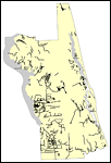
Florida Waterways: Pasco County Outline, 2008
This map was created by FCIT and shows the waterways of Pasco County. All major rivers, streams, creeks, lakes, and swamps are labeled. This map features Withlacoochee River, Lake Pasadena, Bayou Branch, Hillsborough River, Indian Creek, New River, B...

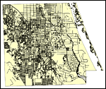
Florida Waterways: Pinellas County Outline, 2008
This map was created by FCIT and shows the waterways of Pinellas County. All major rivers, streams, creeks, lakes, and swamps are labeled. This map features Anclote River, Hollin Creek, Lake Tarpon, Curlew Creek, Cedar Creek, Jerry Branch, Bishop Cre...

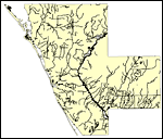
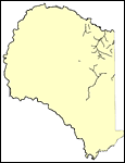
Florida Waterways: Polk County Outline, 2008
This map was created by FCIT and shows the waterways of Polk County. All major rivers, streams, creeks, lakes, and swamps are labeled. This map features Withlacoochee River, Withlacoochee River South, Mattress Drain, Grass Creek, Pony Creek, Gator Cr...

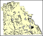
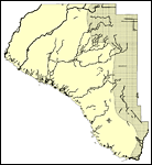
Florida Waterways: Putnam County Outline, 2008
This map was created by FCIT and shows the waterways of Putnam County. All major rivers, streams, creeks, lakes, and swamps are labeled. This map features Cedar Creek, Fish Creek, Saint Johns River, Mill Branch, Simms Creek, Rice Creek, Etonia Creek,...

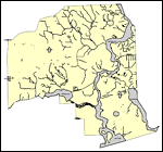
Florida Waterways: Santa Rosa County Outline, 2008
This map was created by FCIT and shows the waterways of Santa Rosa County. All major rivers, streams, creeks, lakes, and swamps are labeled. This map features Bray Mill Creek, Holly Creek, McCostill Mill Creek, Diamond Creek, Escambia River, Bell Cre...

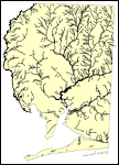
Florida Waterways: Sarasota County Outline, 2008
This map was created by FCIT and shows the waterways of Sarasota County. All major rivers, streams, creeks, lakes, and swamps are labeled. This map features Cooper Creek, Ogleby Creek, Cow Pen Slough, Philippee Creek, Howard Creek, Lake Myakka, Catfi...

Florida Waterways: Seminole County Outline, 2008
This map was created by FCIT and shows the waterways of Seminole County. All major rivers, streams, creeks, lakes, and swamps are labeled. This map features Wekiva River, Lake Monroe, Little Wekiva River, Gee Creek, Saint Johns River, Lake Harney, La...

Florida Waterways: St Johns County Outline, 2008
This map was created by FCIT and shows the waterways of Saint Johns County. All major rivers, streams, creeks, lakes, and swamps are labeled. This map features Cabbage Creek, Flora Branch, Cunningham Creek, Burbin Creek, Trout Creek, Capo Creek, Tolo...

Florida Waterways: St Lucie County Outline, 2008
This map was created by FCIT and shows the waterways of Saint Lucie County. All major rivers, streams, creeks, lakes, and swamps are labeled. This map features Indian River, St. Lucie River, Long Creek, and North Fork Saint Lucie River....

Florida Waterways: Sumter County Outline, 2008
This map was created by FCIT and shows the waterways of Sumter County. All major rivers, streams, creeks, lakes, and swamps are labeled. This map features Gum Slough, Withlacoochee River South, Little Jones Creek, Johns Lake, Jumper Creek, Big Prairi...

Florida Waterways: Suwannee County Outline, 2008
This map was created by FCIT and shows the waterways of Suwannee County. All major rivers, streams, creeks, lakes, and swamps are labeled. This map features Rocky Creek, Suwannee River, and Santa Fe River....

Florida Waterways: Taylor County Outline, 2008
This map was created by FCIT and shows the waterways of Taylor County. All major rivers, streams, creeks, lakes, and swamps are labeled. This map features Econfina River, Rocky Creek, Pimple Creek, Woods Creek, Spring Creek, Aucilla River, Wacissa Ri...

Florida Waterways: Union County Outline, 2008
This map was created by FCIT and shows the waterways of Union County. All major rivers, streams, creeks, lakes, and swamps are labeled. This map features Palestine Lake, Olustee Creek, Swift Creek, New River, Turkey Creek, Richard Creek, Fivemile Cre...

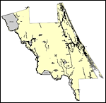
Florida Waterways: Volusia County Outline, 2008
This map was created by FCIT and shows the waterways of Volusia County. All major rivers, streams, creeks, lakes, and swamps are labeled. This map features Bulow Creek, Halifax River, Priest Branch, Tomoka River, Spruce Creek, Indian River North, Cre...

Florida Waterways: Wakulla County Outline, 2008
This map was created by FCIT and shows the waterways of Wakulla County. All major rivers, streams, creeks, lakes, and swamps are labeled. This map features Sweetwater Creek, Panther Branch, Pine Creek, Betsy Branch, Sopchoppy River, Monkey Creek, Lan...

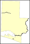
Florida Waterways: Walton County Outline, 2008
This map was created by FCIT and shows the waterways of Walton County. All major rivers, streams, creeks, lakes, and swamps are labeled. This map features Shoal River and Choctawatchee River....

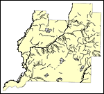
Florida Waterways: Washington County Outline, 2008
This map was created by FCIT and shows the waterways of Washington County. All major rivers, streams, creeks, lakes, and swamps are labeled. This map features Brock Mill Branch, Dram Branch, Flat Creek, Potter Branch, Hard Labor Creek, Pate Lake, Pin...

First Previous


  FL Maps > County Maps with Labeled Waterways
Site Map  

Maps ETC is a part of the Educational Technology Clearinghouse
Produced by the Florida Center for Instructional Technology © 2007
College of Education , University of South Florida