Maps Site map
  FL Maps > County Maps with Unlabeled Waterways
Site Map  

  Record   1   to   25  of   66

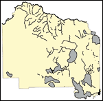
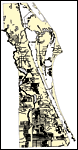
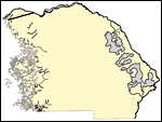
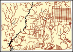
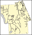
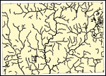
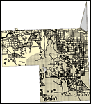
Florida Waterways: Alachua County Outline without Labels, 2008
This map was created by FCIT and shows the waterways of Alachua County. All major rivers, streams, creeks, canals, bays and lakes are present, but not labeled. For a student activity sheet with directions for labeling the following: Santa Fe River, S...

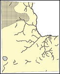
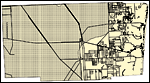
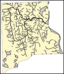
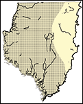
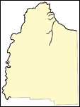
Florida Waterways: Baker County Outline without Labels, 2008
This topographical map was created by FCIT and shows the waterways of Baker County. All major rivers, streams, creeks, canals, bays and lakes are present, but not labeled. For a student activity sheet with directions for labeling the following: St. M...

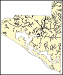
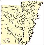
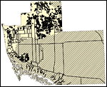
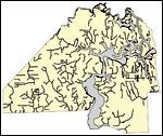
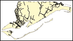
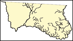
Florida Waterways: Bay County Outline without Labels, 2008
This topographical map was created by FCIT and shows the waterways of Bay County. All major rivers, streams, creeks, canals, bays and lakes are present, but not labeled. For a student activity sheet with directions for labeling the following: West Ba...

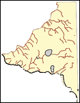
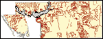
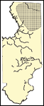
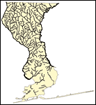
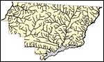
Florida Waterways: Bradford County Outline without Labels, 2008
This topographical map was created by FCIT and shows the waterways of Bradford County. All major rivers, streams, creeks, canals, bays and lakes are present, but not labeled. For a student activity sheet with directions for labeling the following: Sa...

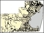
Florida Waterways: Brevard County Outline without Labels, 2008
This topographical map was created by FCIT and shows the waterways of Brevard County. All major rivers, streams, creeks, canals, bays and lakes are present, but not labeled. For a student activity sheet with directions for labeling the following: St....

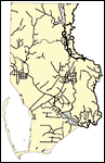
Florida Waterways: Broward County Outline without Labels, 2008
This topographical map was created by FCIT and shows the waterways of Broward County. All major rivers, streams, creeks, canals, bays and lakes are present, but not labeled. For a student activity sheet with directions for labeling the following: The...

Florida Waterways: Calhoun County Outline without Labels, 2008
This topographical map was created by FCIT and shows the waterways of Calhoun County. All major rivers, streams, creeks, canals, bays and lakes are present, but not labeled. For a student activity sheet with directions for labeling the following: Chi...

Florida Waterways: Charlotte County Outline without Labels, 2008
This topographical map was created by FCIT and shows the waterways of Charlotte County. All major rivers, streams, creeks, canals, bays and lakes are present, but not labeled. For a student activity sheet with directions for labeling the following: P...

Florida Waterways: Citrus County Outline without Labels, 2008
This topographical map was created by FCIT and shows the waterways of Citrus County. All major rivers, streams, creeks, canals, bays and lakes are present, but not labeled. For a student activity sheet with directions for labeling the following: Tsal...

Florida Waterways: Clay County Outline without Labels, 2008
This topographical map was created by FCIT and shows the waterways of Clay County. All major rivers, streams, creeks, canals, bays and lakes are present, but not labeled. For a student activity sheet with directions for labeling the following: St. Jo...

Florida Waterways: Collier County Outline without Labels, 2008
This topographical map was created by FCIT and shows the waterways of Collier County. All major rivers, streams, creeks, canals, bays and lakes are present, but not labeled. For a student activity sheet with directions for labeling the following: Lak...

Florida Waterways: Columbia County Outline without Labels, 2008
This topographical map was created by FCIT and shows the waterways of Columbia County. All major rivers, streams, creeks, canals, bays and lakes are present, but not labeled. For a student activity sheet with directions for labeling the following: Su...

Florida Waterways: DeSoto County Outline without Labels, 2008
This topographical map was created by FCIT and shows the waterways of DeSoto County. All major rivers, streams, creeks, canals, bays and lakes are present, but not labeled. For a student activity sheet with directions for labeling the following: Peac...

Florida Waterways: Dixie County Outline without Labels, 2008
This topographical map was created by FCIT and shows the waterways of Dixie County. All major rivers, streams, creeks, canals, bays and lakes are present, but not labeled. For a student activity sheet with directions for labeling the following: Stein...

Florida Waterways: Duval County Outline without Labels, 2008
This topographical map was created by FCIT and shows the waterways of Duval County. All major rivers, streams, creeks, canals, bays and lakes are present, but not labeled. For a student activity sheet with directions for labeling the following: St. J...

Florida Waterways: Escambia County Outline without Labels, 2008
This topographical map was created by FCIT and shows the waterways of Escambia County. All major rivers, streams, creeks, canals, bays and lakes are present, but not labeled. For a student activity sheet with directions for labeling the following: Es...

Florida Waterways: Flagler County Outline without Labels, 2008
This topographical map was created by FCIT and shows the waterways of Flagler County. All major rivers, streams, creeks, canals, bays and lakes are present, but not labeled. For a student activity sheet with directions for labeling the following: Cre...

Florida Waterways: Franklin County Outline without Labels, 2008
This topographical map was created by FCIT and shows the waterways of Franklin County. All major rivers, streams, creeks, canals, bays and lakes are present, but not labeled. For a student activity sheet with directions for labeling the following: Oc...

Florida Waterways: Gadsden County Outline without Labels, 2008
This topographical map was created by FCIT and shows the waterways of Gadsden County. All major rivers, streams, creeks, canals, bays and lakes are present, but not labeled. For a student activity sheet with directions for labeling the following: Apa...

Florida Waterways: Gilchrist County Outline without Labels, 2008
This topographical map was created by FCIT and shows the waterways of Gilchrist County. All major rivers, streams, creeks, canals, bays and lakes are present, but not labeled. For a student activity sheet with directions for labeling the following: S...

Florida Waterways: Glades County Outline without Labels, 2008
This topographical map was created by FCIT and shows the waterways of Glades County. All major rivers, streams, creeks, canals, bays and lakes are present, but not labeled. For a student activity sheet with directions for labeling the following: Lake...

Florida Waterways: Gulf County Outline without Labels, 2008
This topographical map was created by FCIT and shows the waterways of Gulf County. All major rivers, streams, creeks, canals, bays and lakes are present, but not labeled. For a student activity sheet with directions for labeling the following: Chipol...

Florida Waterways: Hamilton County Outline without Labels, 2008
This topographical map was created by FCIT and shows the waterways of Hamilton County. All major rivers, streams, creeks, canals, bays and lakes are present, but not labeled. For a student activity sheet with directions for labeling the following: Wi...

Florida Waterways: Hardee County Outline without Labels, 2008
This topographical map was created by FCIT and shows the waterways of Hardee County. All major rivers, streams, creeks, canals, bays and lakes are present, but not labeled. For a student activity sheet with directions for labeling the following: Peac...

Florida Waterways: Hendry County Outline without Labels, 2008
This topographical map was created by FCIT and shows the waterways of Hendry County. All major rivers, streams, creeks, canals, bays and lakes are present, but not labeled. For a student activity sheet with directions for labeling the following: Calo...

Next Last


  FL Maps > County Maps with Unlabeled Waterways
Site Map  

Maps ETC is a part of the Educational Technology Clearinghouse
Produced by the Florida Center for Instructional Technology © 2007
College of Education , University of South Florida