|
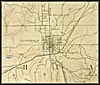
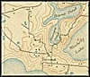
1894, Gainesville Area, Florida. Detail view from a United States
Geological Survey map |
|
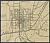
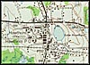
1894, Gainesville Town Center, Florida. Detail view from a United
States Geological Survey map |
|
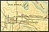
1894, Micanopy, Florida. Detail view from a United States Geological
Survey map |
|
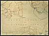
1894, Payne Prairie, Florida. Detail view from a United States Geological
Survey map |
|
1894, Tacoma, Florida. Detail view from a United States Geological
Survey map |
|
1943, Hawthorn, Florida. Detail view from a United States Geological
Survey map |
|
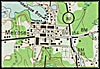
1943, Melrose, Florida. Detail view from a United States Geological
Survey map |
|
1943, Orange Heights, Florida. Detail view from a United States
Geological Survey map |
|
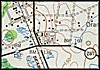
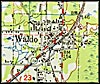
1949, Waldo, Florida. Detail view from a United States Geological
Survey map |