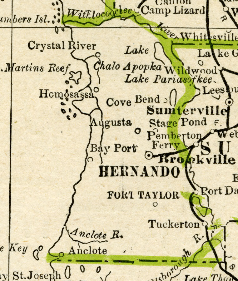
Description: A map of Hernando County showing county lines, the county seat (Brooksville), and railroads connecting the major cities current to 1886.
Place Names: Hernando, Crystal River, Homosassa, Cove, Bend, Augusta, Fort Taylor, Tuckerton, Anclote, Bayport, Brooksville
ISO Topic Categories: boundaries, inlandWaters, oceans, transportation
Keywords: Hernando County, physical, political, transportation, physical features, major political subdivisions, county borders, railroads, boundaries, inlandWaters, oceans, transportation, Unknown,1886
Source: George F. Cram, (Chicago, IL: Geo. F. Cram, 1886) 63
Map Credit: Courtesy the private collection of Roy Winkelman |
|