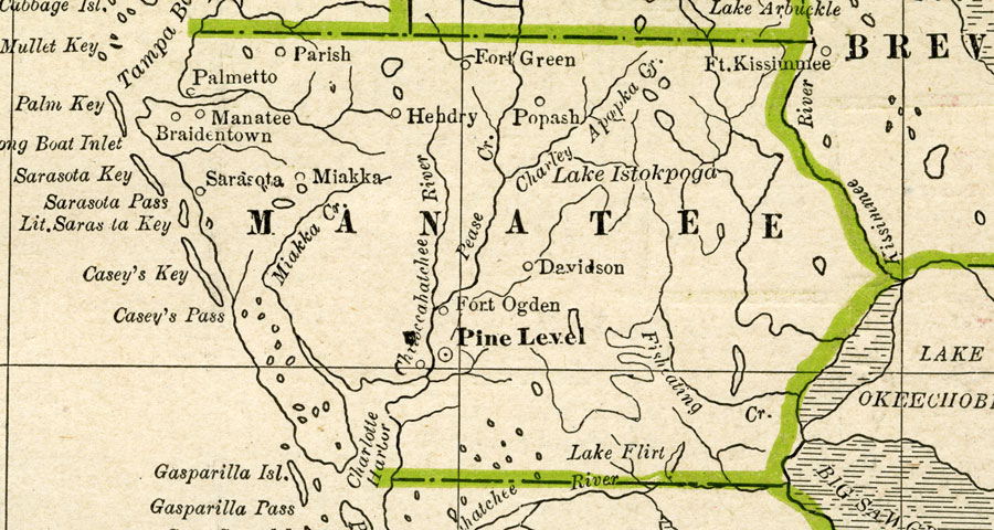
Description: A map of Manatee County showing county lines, the county seat (Pine Level), and railroads connecting the major cities current to 1886.
Place Names: Manatee, Palmetto, Parish, Bradenton, Braidentown, Sarasota, Myakka City, Miakka, Fort Green, Popash, Davidson, Fort Ogden, Pine Level
ISO Topic Categories: boundaries, inlandWaters, oceans, transportation
Keywords: Manatee County, physical, political, transportation, physical features, county borders, railroads, boundaries, inlandWaters, oceans, transportation, Unknown,1886
Source: George F. Cram, (Chicago, IL: Geo. F. Cram, 1886) 63
Map Credit: Courtesy the private collection of Roy Winkelman |
|