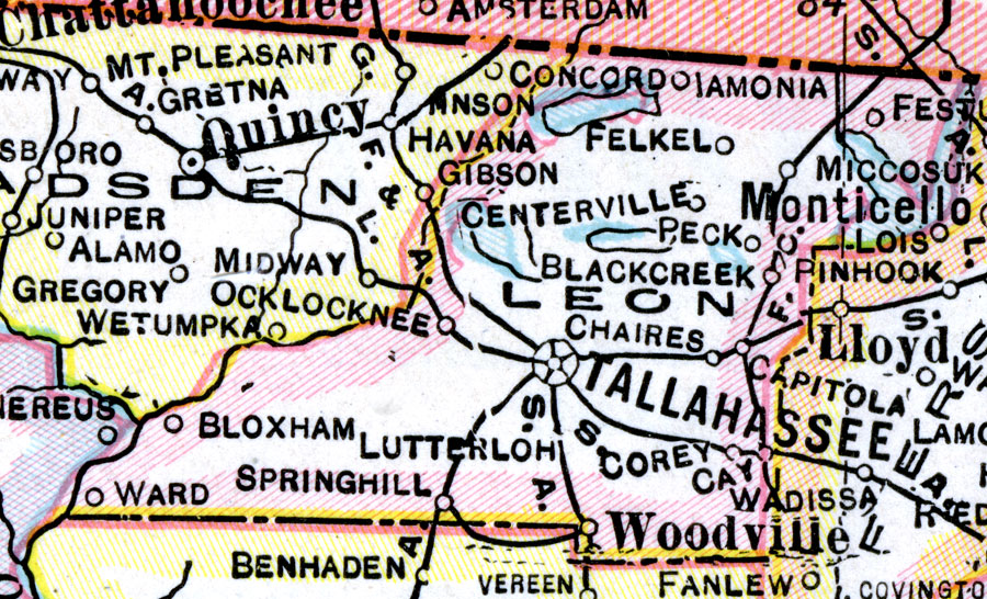
Description: A map of Leon County showing county lines, the county seat (and State Capital: Tallahassee), and railroads connecting the major cities current to 1921.
Place Names: Leon, Ocklockonee, Tallahassee, Bloxham, Ward, Spring Hill, Lutterloh, Corey, Chaires, Centreville, Concord, Lamonia, Miccosukee
ISO Topic Categories: boundaries, inlandWaters, transportation
Keywords: Leon County, physical, political, transportation, physical features, county borders, railroads, boundaries, inlandWaters, transportation, Unknown,1921
Source: George F. Cram, (Chicago, IL: George F. Cram Company, 1921) 46
Map Credit: Courtesy the private collection of Roy Winkelman. |
|