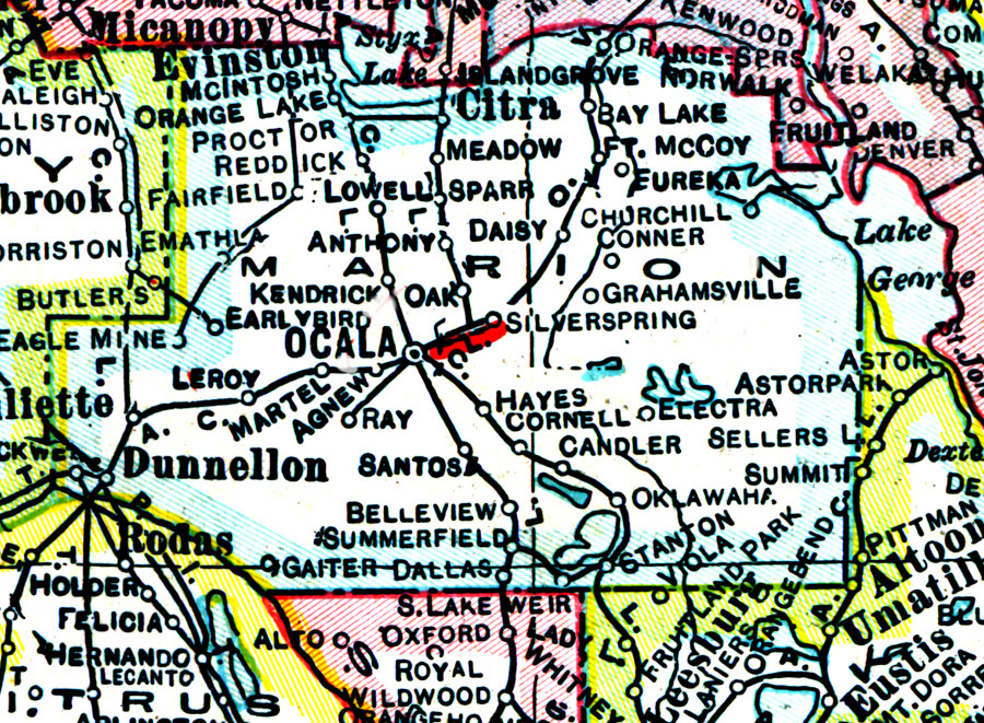
Description: A map of Marion County showing county lines, the county seat (Ocala), and railroads connecting the major cities current to 1921.
Place Names: Marion, McIntosh, Reddick, Ocala, Dunnellon, Leroy, Belleview, Summerfield, Hayes Siding, Ocklawaha, Citra, Orange Springs, Fort McCoy, Eureka
ISO Topic Categories: boundaries, inlandWaters, transportation
Keywords: Marion County, physical, political, transportation, physical features, county borders, railroads, boundaries, inlandWaters, transportation, Unknown,1921
Source: George F. Cram, (Chicago, IL: George F. Cram Company, 1921) 46
Map Credit: Courtesy the private collection of Roy Winkelman. |
|