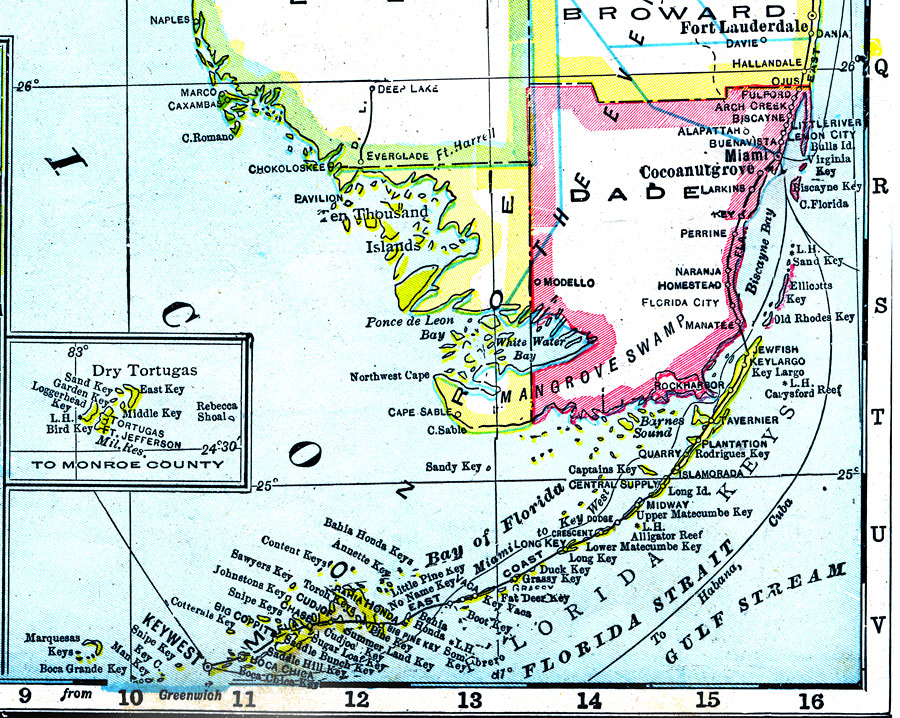
Description: A map of Monroe County showing county lines, the county seat (Key West), railroads connecting the major cities, and shipping routes current to 1921.
Place Names: Monroe, Cape Sable, Key Largo, Rock Harbor, Tavernier, Islamorada, Key West, Shell Key, Sugarloaf Key, Ten Thousand Islands
ISO Topic Categories: boundaries, inlandWaters, oceans, transportation
Keywords: Monroe County, physical, political, transportation, physical features, county borders, railroads, water routes, boundaries, inlandWaters, oceans, transportation, Unknown,1921
Source: George F. Cram, (Chicago, IL: George F. Cram Company, 1921) 46
Map Credit: Courtesy the private collection of Roy Winkelman. |
|