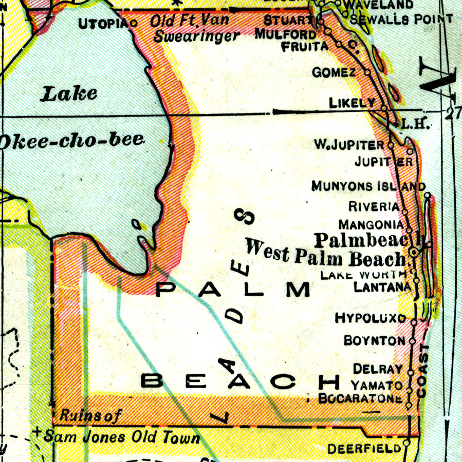
Description: A map of Palm Beach County showing county lines, the county seat (West Palm Beach), and railroads connecting the major cities current to 1921. Also shown are Everglades drainage Canals.
Place Names: Palm Beach, Jupiter, Palm Beach, West Palm Beach, Lake Worth, Hypoluxo, Delray Beach, Yamato, Boca Raton, Bocaraton, Stuart, Mulford, Fruita, Gomez, Likely
ISO Topic Categories: boundaries, inlandWaters, oceans, transportation
Keywords: Palm Beach County, physical, political, transportation, physical features, county borders, railroads, boundaries, inlandWaters, oceans, transportation, Unknown,1921
Source: George F. Cram, (Chicago, IL: George F. Cram Company, 1921) 46
Map Credit: Courtesy the private collection of Roy Winkelman. |
|