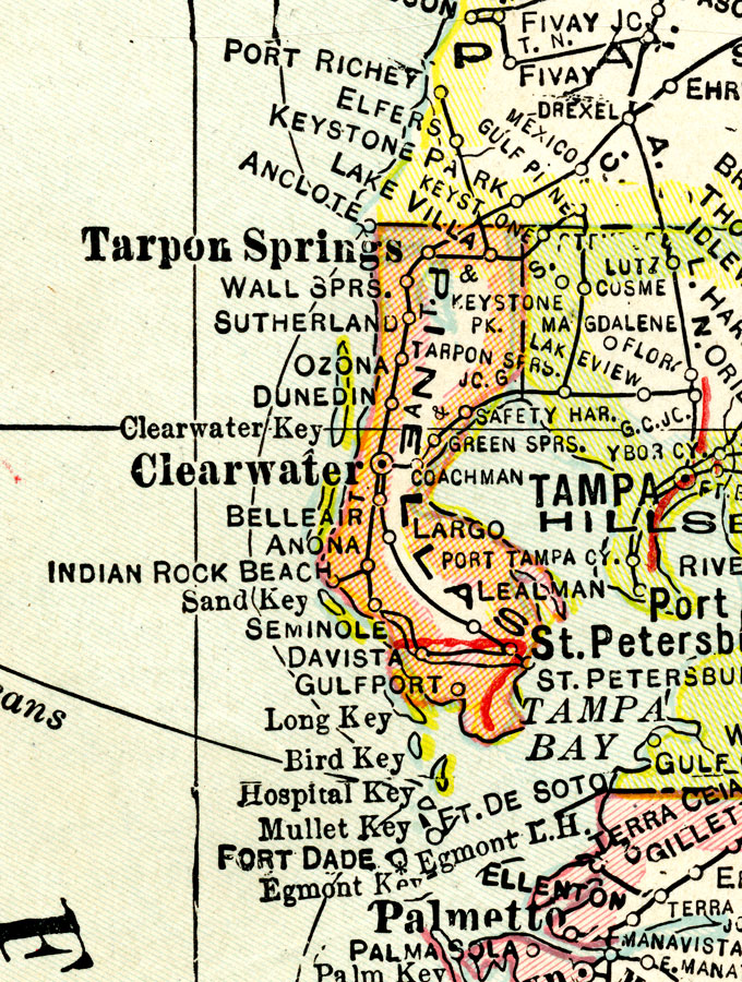
Description: A map of Pinellas County showing county lines, the county seat (Clearwater), and railroads connecting the major cities current to 1921.
Place Names: Pinellas, Tarpon Springs, Ozona, Dunedin, Clearwater, Belleair, Indian Rocks Beach, Seminole, Gulfport, St. Petersburg, Largo, Safety Harbor
ISO Topic Categories: boundaries, oceans, transportation, inlandWaters
Keywords: Pinellas County, physical, political, transportation, physical features, county borders, railroads, boundaries, oceans, transportation, inlandWaters, Unknown,1921
Source: George F. Cram, (Chicago, IL: George F. Cram Company, 1921) 46
Map Credit: Courtesy the private collection of Roy Winkelman. |
|