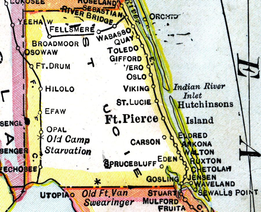
Description: A map of St. Lucie County showing county lines, the county seat (Fort Pierce), and railroads connecting the major cities current to 1921.
Place Names: St. Lucie, Wabasso, Fellsmere, Quay, Oslo, Viking, St. Lucie, Ft. Pierce, Hutchinson Island, Eldred, Ankona, Walton, Fort Drum, Hilolo, Efaw, Opal, Okeechobee, Gosling
ISO Topic Categories: boundaries, inlandWaters, oceans, transportation
Keywords: St. Lucie County, physical, political, transportation, physical features, county borders, railroads, boundaries, inlandWaters, oceans, transportation, Unknown,1921
Source: George F. Cram, (Chicago, IL: George F. Cram Company, 1921) 46
Map Credit: Courtesy the private collection of Roy Winkelman. |
|