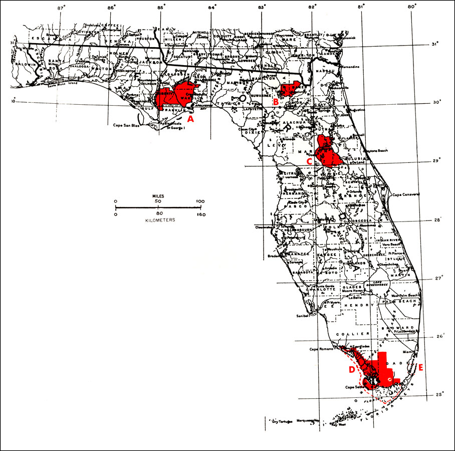
Description: This map shows A) Apalachicola, B) Osceola, C) National Forests, D) Everglades National Park and E) Biscayne National Monument. "Trees of many species are found within the publicly owned lands dedicated to the management or preservation of the renewable natural resources. Comparisons with a tree species map will indicate whether that species may be expected within the boundary." —Elbert L. Little, Jr. For more information, read the introduction to the Atlas of United States Trees Vol. 5 Florida.
Place Names: 1950-1999, Miami, Cape Canaveral, Daytona Beach, Fort Myers, St Petersburg, Tampa, Tallahassee, Jacksonville, Sarasota, Saint Augustine, West Palm Beach, Orlando, Apalachicola, Osceola, Ocala, Everglades National Park, Biscayne National Monument
ISO Topic Categories: boundaries, inlandWaters
Keywords: National Forests, Everglades National Park, and Biscayne National Monument, political, physical, physical features, major political subdivisions, county borders, boundaries, inlandWaters, Unknown,1978
Source: Elbert L. Little, Jr., Atlas of United States Trees Volume 5 Florida (Washington, D.C.: United States Government Printing Office, 1978)
Map Credit: Courtesy the private collection of Roy Winkelman. |
|