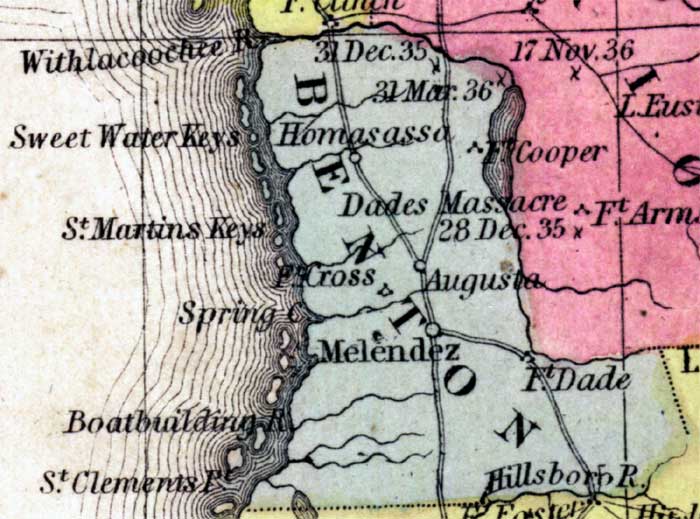
Description: This detail of a 1850 map from the New Universal Atlas shows towns, forts, roads, canals, major rivers and lakes in Benton County. The map is very similar to the 1839 map from Tanner's Universal Atlas. There are references to forts, battlefields, and routes used by the Army during the Seminole War. Benton County is bordered by the Gulf of Mexico and the Withlacoochee River. Dates of battles are labeled over locations. Dades Massacre is noted as well.
Place Names: Hernando, Homosassa, Ft. Dade, Dades Massacre, Augusta, Melendez, Fort Cross, Fort Cooper, Withlacoochee River, Sweet Water Keys, Saint Martins Keys, Spring Creek, Boatbuilding River, Saint Clements Point, Hillsboro River,
ISO Topic Categories: boundaries, inlandWaters, oceans, society, transportation
Keywords: Benton County, physical, political, transportation, historical, physical features, county borders, roads, other military, boundaries, inlandWaters, oceans, society, transportation, Unknown,1850
Source: Samuel Augustus Mitchell, A New Universal Atlas (Philadelphia, PA: Thomas, Cowperthwait & Co., 1850) 21
Map Credit: Courtesy the private collection of Roy Winkelman |
|