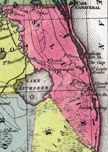
Description: This detail of a 1850 map from the New Universal Atlas shows towns, forts, roads, canals, major rivers and lakes in Saint Lucie County. The map is very similar to the 1839 map from Tanner's Universal Atlas. There are references to forts, battlefields, and routes used by the Army during the Seminole War. The Indian River flows parallel to the east coast. Points of interest include Fort Pierce, Rocky Spring, and Fort Jupiter.
Place Names: St. Lucie, Lake Poinsett, Indian River, Lake Gentry, Kissimmee River, Lake Okechobee, Lake Okeechobee, Fort Lloyds, Fort Pierce, Indian River Inlet, The Gap, Saint Lucie Rocks, Bleach Yard, Jupiter, Rocky Spring, Fort Jupiter, Potomac River,
ISO Topic Categories: boundaries, inlandWaters, oceans, society, transportation
Keywords: St. Lucie County, physical, political, transportation, historical, physical features, county borders, roads, other military, boundaries, inlandWaters, oceans, society, transportation, Unknown,1850
Source: Samuel Augustus Mitchell, A New Universal Atlas (Philadelphia, PA: Thomas, Cowperthwait & Co., 1850) 21
Map Credit: Courtesy the private collection of Roy Winkelman |
|